MyTopo
Seward Kansas US Topo Map
Couldn't load pickup availability
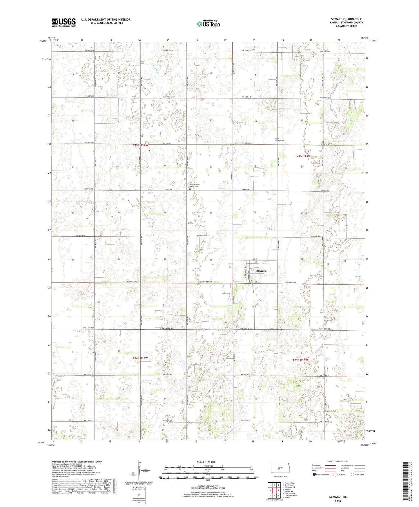
2022 topographic map quadrangle Seward in the state of Kansas. Scale: 1:24000. Based on the newly updated USGS 7.5' US Topo map series, this map is in the following counties: Stafford. The map contains contour data, water features, and other items you are used to seeing on USGS maps, but also has updated roads and other features. This is the next generation of topographic maps. Printed on high-quality waterproof paper with UV fade-resistant inks.
Quads adjacent to this one:
West: Radium
Northwest: Pawnee Rock
North: Great Bend
Northeast: Ellinwood SW
East: Hudson NW
Southeast: Hudson
South: Saint John North
Southwest: Saint John SW
This map covers the same area as the classic USGS quad with code o38098b7.
Contains the following named places: City of Seward, Eden Valley Cemetery, Great Bend Co - Operative Association Grain Elevator Number 5, Saint Francis Xavier Cemetery, Seward, Stafford County Rural Fire Department Station 470, Township of Douglas, Township of Lincoln