MyTopo
Peabody NW Kansas US Topo Map
Couldn't load pickup availability
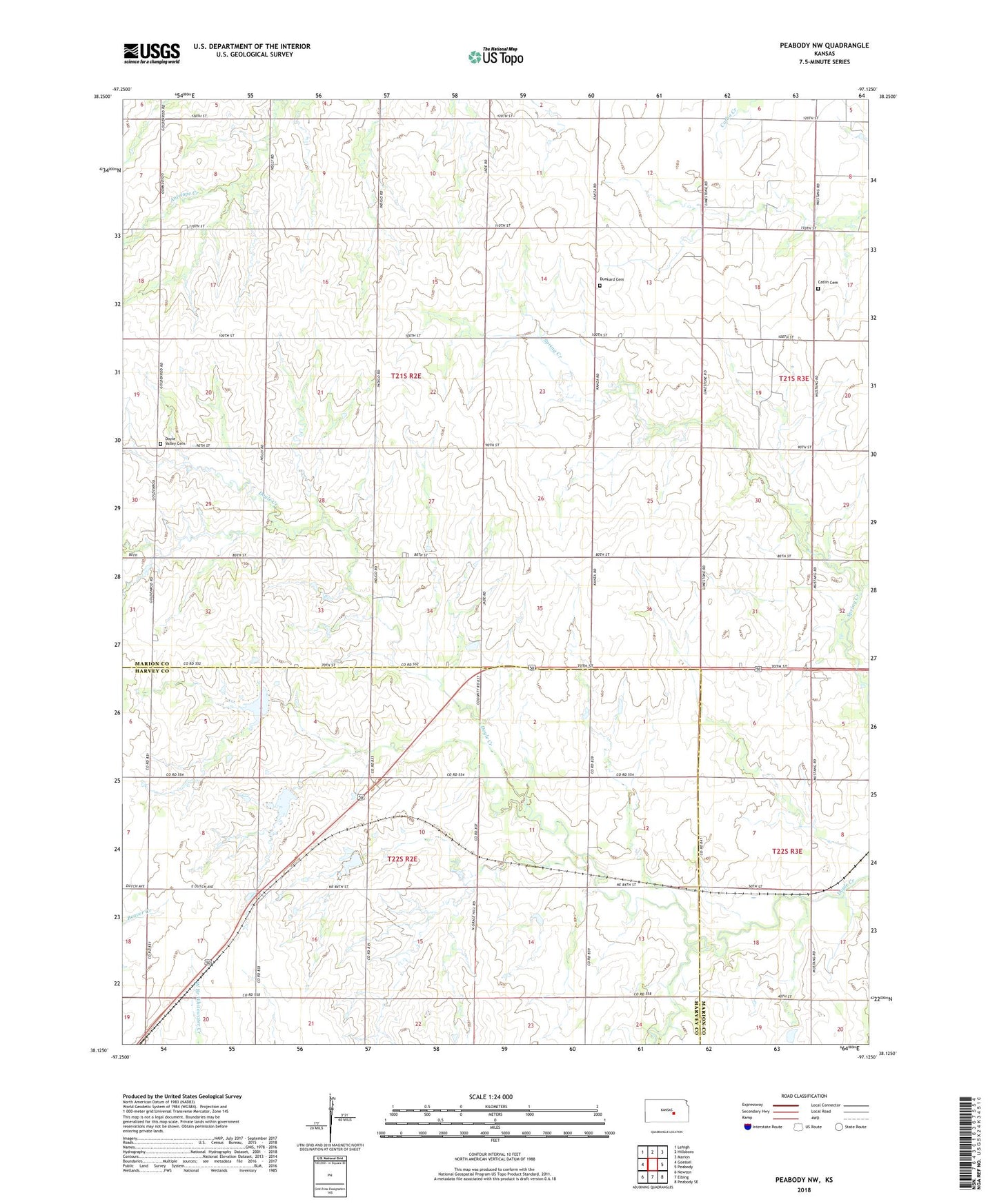
2022 topographic map quadrangle Peabody NW in the state of Kansas. Scale: 1:24000. Based on the newly updated USGS 7.5' US Topo map series, this map is in the following counties: Marion, Harvey. The map contains contour data, water features, and other items you are used to seeing on USGS maps, but also has updated roads and other features. This is the next generation of topographic maps. Printed on high-quality waterproof paper with UV fade-resistant inks.
Quads adjacent to this one:
West: Goessel
Northwest: Lehigh
North: Hillsboro
Northeast: Marion
East: Peabody
Southeast: Peabody SE
South: Elbing
Southwest: Newton
This map covers the same area as the classic USGS quad with code o38097b2.
Contains the following named places: Bond School, Catlin Cemetery, Catlin Church, Center School, Doyle Valley Cemetery, Dunkard Cemetery, Gilley's Airport, Pleasant Valley School, Ridge School, Southwest Unger Oil Field, Township of East Branch, Township of Walton, Wareham School, Weaver School