MyTopo
Potter Kansas US Topo Map
Couldn't load pickup availability
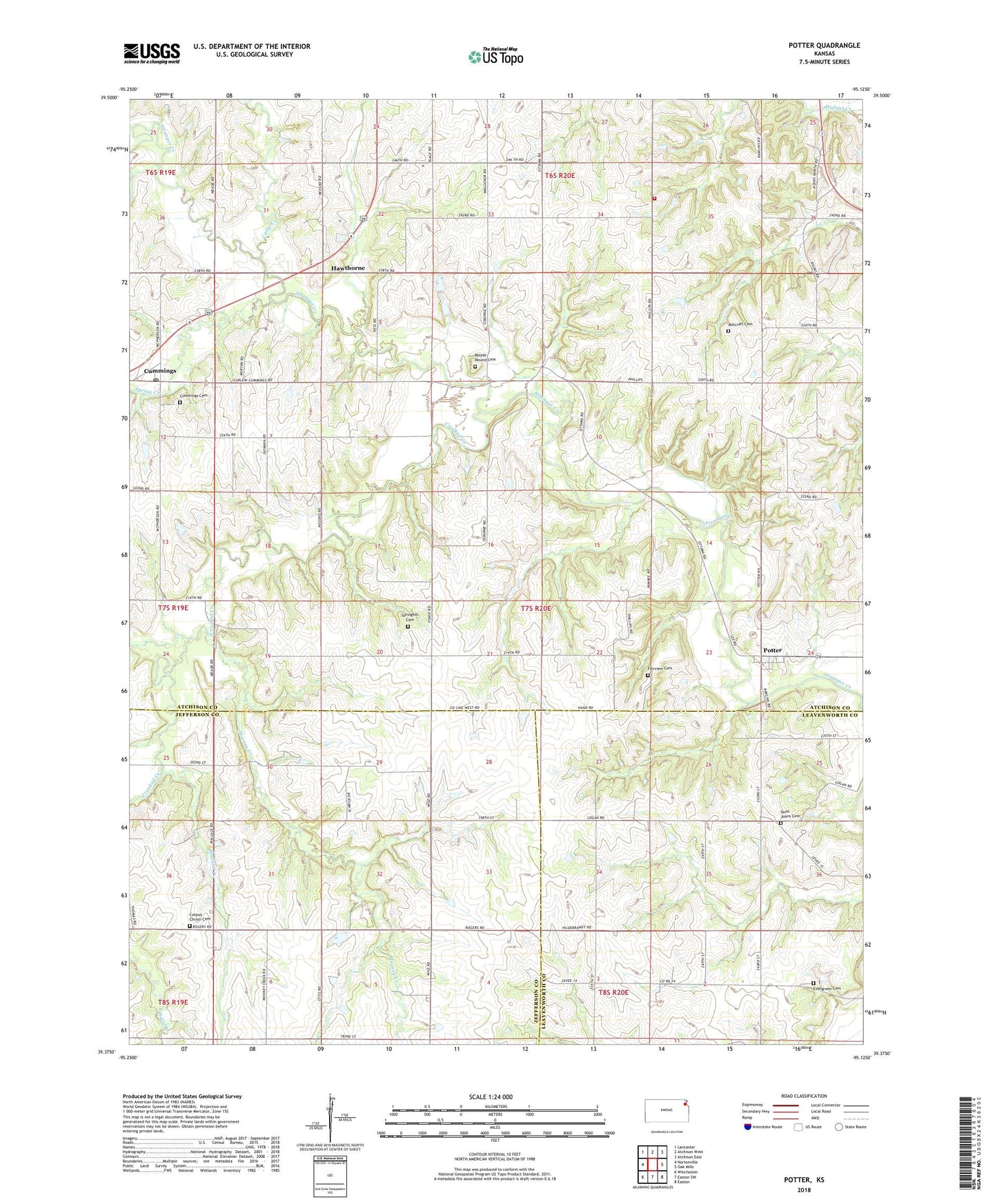
2022 topographic map quadrangle Potter in the state of Kansas. Scale: 1:24000. Based on the newly updated USGS 7.5' US Topo map series, this map is in the following counties: Atchison, Jefferson, Leavenworth. The map contains contour data, water features, and other items you are used to seeing on USGS maps, but also has updated roads and other features. This is the next generation of topographic maps. Printed on high-quality waterproof paper with UV fade-resistant inks.
Quads adjacent to this one:
West: Nortonville
Northwest: Lancaster
North: Atchison West
Northeast: Atchison East
East: Oak Mills
Southeast: Easton
South: Easton SW
Southwest: Winchester
This map covers the same area as the classic USGS quad with code o39095d2.
Contains the following named places: Ashcraft Cemetery, Atchison County Rural Fire District 4 - Mount Pleasant, Camp Creek, Corpus Christi Cemetery, Corpus Christi School, Crooked Creek, Cummings, Cummings Christian Church, Cummings District Cemetery, Cummings Post Office, Cummings United Methodist Church, Evergreen Cemetery, Fairview Cemetery, Hawthorne, Hawthorne Elementary School, Howard Creek, Locust Grove, Mooney Creek, Mount Pleasant, Potter, Potter Community Church, Round Mound Cemetery, Saint Johns Lutheran Cemetery, Saint John's Lutheran Church, Spring Creek, Springhill Cemetery, Township of Mount Pleasant, ZIP Code: 66016