MyTopo
Winchester Kansas US Topo Map
Couldn't load pickup availability
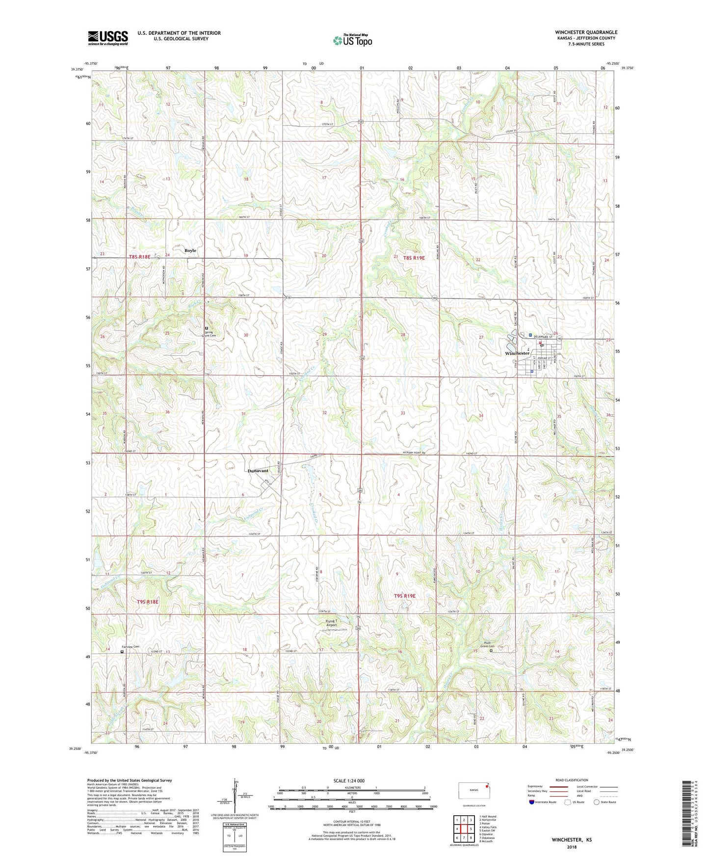
2022 topographic map quadrangle Winchester in the state of Kansas. Scale: 1:24000. Based on the newly updated USGS 7.5' US Topo map series, this map is in the following counties: Jefferson. The map contains contour data, water features, and other items you are used to seeing on USGS maps, but also has updated roads and other features. This is the next generation of topographic maps. Printed on high-quality waterproof paper with UV fade-resistant inks.
Quads adjacent to this one:
West: Valley Falls
Northwest: Half Mound
North: Nortonville
Northeast: Potter
East: Easton SW
Southeast: McLouth
South: Oskaloosa
Southwest: Ozawkie
This map covers the same area as the classic USGS quad with code o39095c3.
Contains the following named places: Boyle, City of Winchester, Courtney Farms, Dunavant, F W Huston Medical Center, Fairview Cemetery, Flying T Airport, Grayson School, Jefferson County North High School, Jefferson County North School District Offices, Jefferson County Township Fire Department 10 and Winchester Fire Department, Plum Grove Cemetery, Spring Grove Cemetery, Township of Jefferson, Winchester, Winchester Police Department, Winchester Post Office, Winchester Public Library, Winchester Wastewater Treatment Facility