MyTopo
Nortonville Kansas US Topo Map
Couldn't load pickup availability
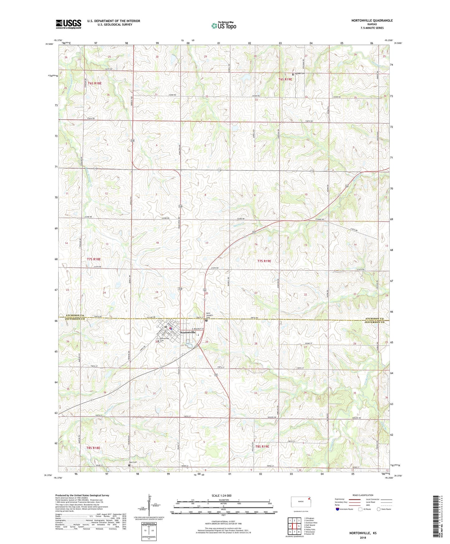
2022 topographic map quadrangle Nortonville in the state of Kansas. Scale: 1:24000. Based on the newly updated USGS 7.5' US Topo map series, this map is in the following counties: Atchison, Jefferson. The map contains contour data, water features, and other items you are used to seeing on USGS maps, but also has updated roads and other features. This is the next generation of topographic maps. Printed on high-quality waterproof paper with UV fade-resistant inks.
Quads adjacent to this one:
West: Half Mound
Northwest: Effingham
North: Lancaster
Northeast: Atchison West
East: Potter
Southeast: Easton SW
South: Winchester
Southwest: Valley Falls
This map covers the same area as the classic USGS quad with code o39095d3.
Contains the following named places: City of Nortonville, Clingan School, Cummings Elementary School, Hart Cemetery, Hulls Branch, Jefferson County Fire Department 12 Nortonville, Jefferson County North Elementary and Middle School, Mount Union School, Noffsinger School, Nortonville, Nortonville Cemetery, Nortonville Pleasant Grove Christian Church, Nortonville Police Department, Nortonville Post Office, Nortonville Public Library, Nortonville Sewer Treatment Plant, Nortonville United Methodist Church, Pardee, Pardee Cemetery, Pardee School, Riverbend Rural Health Clinic, Saint Joseph Catholic Church, Saint Joseph Elementary School, Saint Joseph's Cemetery, Saint Matthews Lutheran Church, Seventh Day Baptist Church, Star School, Township of Center, Township of Norton, Village East Assisted Living Facility, Washington School, ZIP Code: 66060