MyTopo
Murdock Kansas US Topo Map
Couldn't load pickup availability
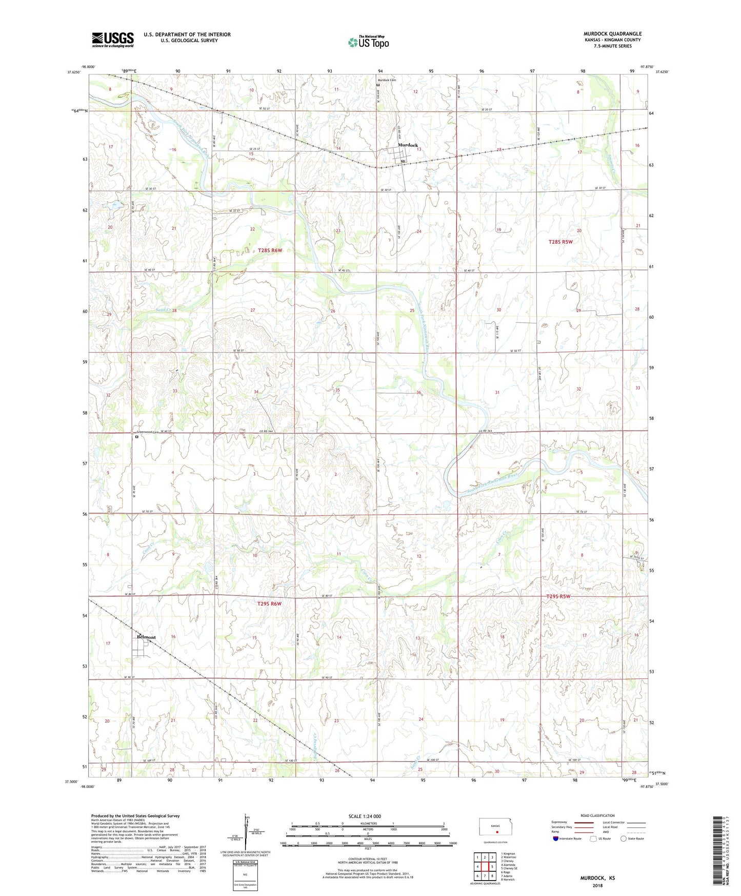
2022 topographic map quadrangle Murdock in the state of Kansas. Scale: 1:24000. Based on the newly updated USGS 7.5' US Topo map series, this map is in the following counties: Kingman. The map contains contour data, water features, and other items you are used to seeing on USGS maps, but also has updated roads and other features. This is the next generation of topographic maps. Printed on high-quality waterproof paper with UV fade-resistant inks.
Quads adjacent to this one:
West: Alameda
Northwest: Kingman
North: Waterloo
Northeast: Cheney
East: Cheney SE
Southeast: Norwich
South: Adams
Southwest: Rago
This map covers the same area as the classic USGS quad with code o37097e8.
Contains the following named places: Belmont, Bolinger Oil Field, Broadway West Oil and Gas Field, Camp Mennoscah, Coon Creek, Dale School, Dewey School, Eagle School, Fairview School, Golden Rule School, Greenwood Cemetery, Mabel, Murdock, Murdock Cemetery, Murdock Census Designated Place, Murdock Elementary School, Murdock Post Office, Pleasant Hill School, Sand Creek, Township of Dale, Township of Eagle, ZIP Code: 67111