MyTopo
Saint Benedict Kansas US Topo Map
Couldn't load pickup availability
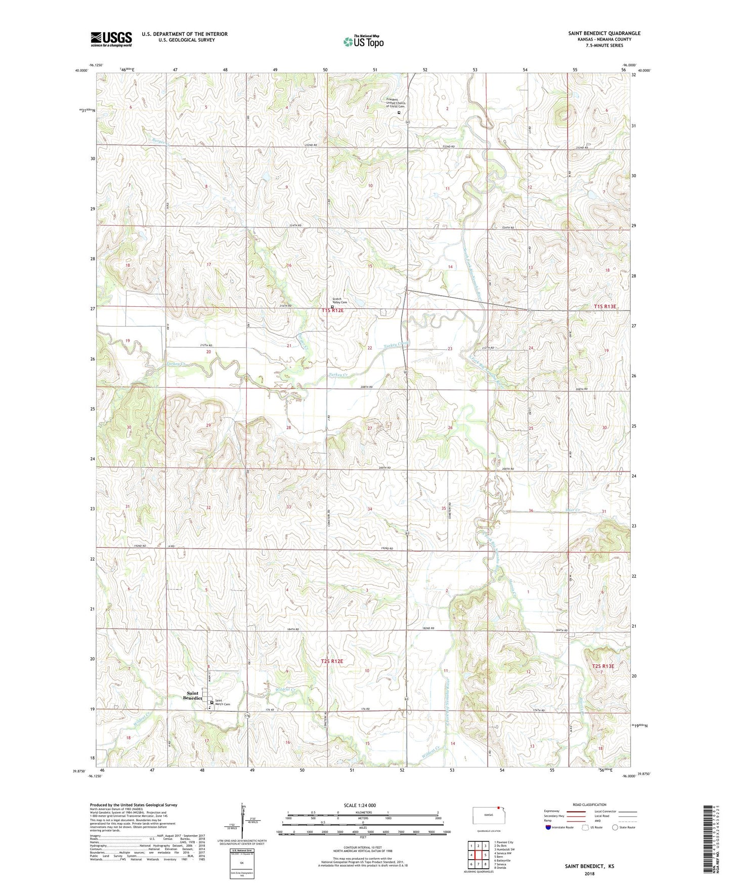
2022 topographic map quadrangle Saint Benedict in the state of Kansas. Scale: 1:24000. Based on the newly updated USGS 7.5' US Topo map series, this map is in the following counties: Nemaha. The map contains contour data, water features, and other items you are used to seeing on USGS maps, but also has updated roads and other features. This is the next generation of topographic maps. Printed on high-quality waterproof paper with UV fade-resistant inks.
Quads adjacent to this one:
West: Seneca NW
Northwest: Pawnee City
North: Du Bois
Northeast: Humboldt SW
East: Bern
Southeast: Oneida
South: Seneca
Southwest: Baileyville
This map covers the same area as the classic USGS quad with code o39096h1.
Contains the following named places: Burger Creek, Deer Creek, Friedens United Church of Christ, Friedens United Church of Christ Cemetery, Harris Creek, Morestown, North Fork Wildcat Creek, Saint Benedict, Saint Benedict Census Designated Place, Saint Benedict Elementary School, Saint Marys Cemetery, Scotch Valley Cemetery, South Fork Wildcat Creek, Taylor Rapids, Township of Nemaha, Turkey Creek, Wildcat Creek