MyTopo
Byron Nebraska US Topo Map
Couldn't load pickup availability
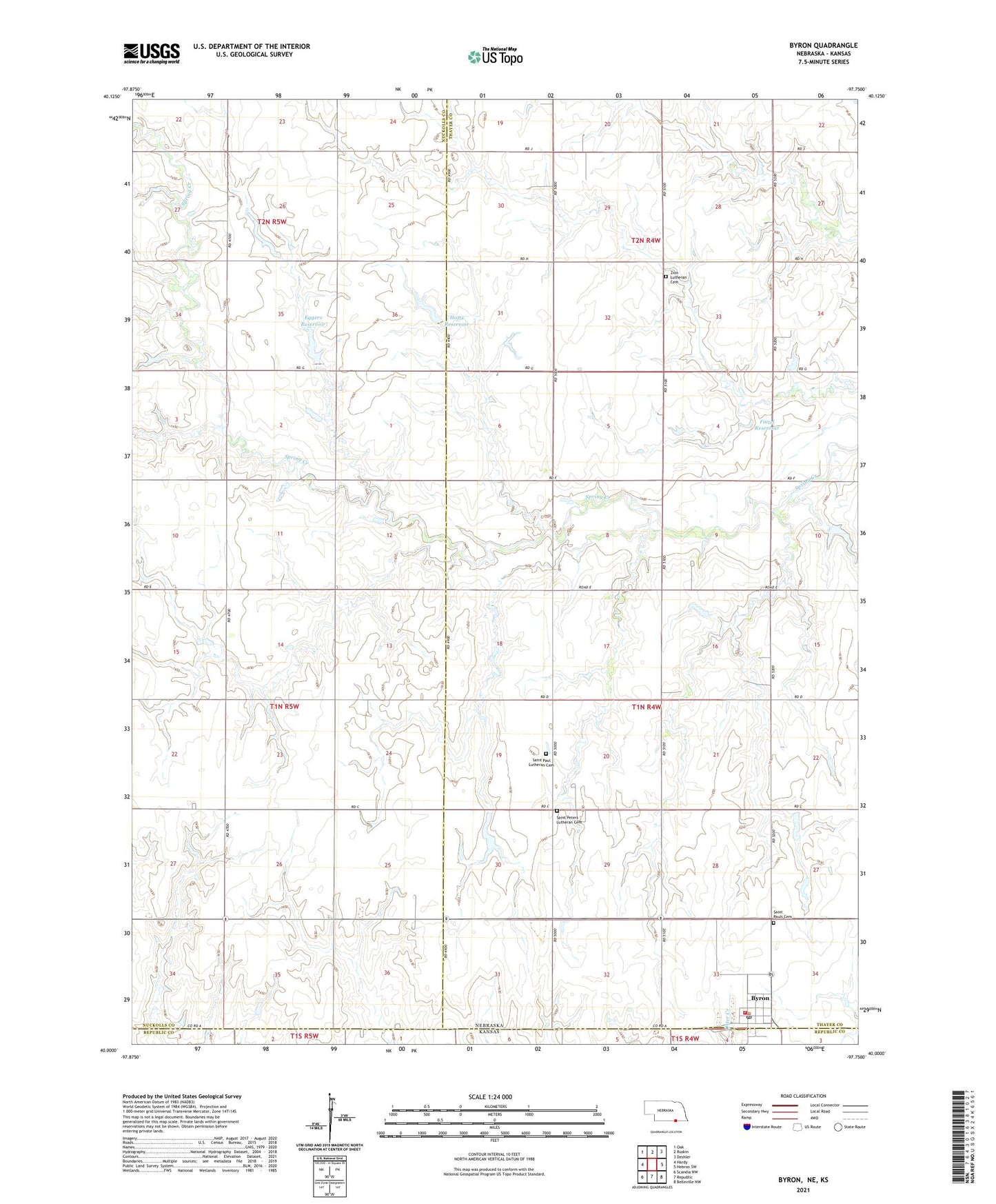
2021 topographic map quadrangle Byron in the state of Nebraska. Scale: 1:24000. Based on the newly updated USGS 7.5' US Topo map series, this map is in the following counties: Thayer, Nuckolls, Republic. The map contains contour data, water features, and other items you are used to seeing on USGS maps, but also has updated roads and other features. This is the next generation of topographic maps. Printed on high-quality waterproof paper with UV fade-resistant inks.
Quads adjacent to this one:
West: Hardy
Northwest: Oak
North: Ruskin
Northeast: Deshler
East: Hebron SW
Southeast: Belleville NW
South: Republic
Southwest: Scandia NW
This map covers the same area as the classic USGS quad with code o40097a7.
Contains the following named places: Bethany Church, Byron, Byron Airport, Byron Elementary School, Byron Post Office, Byron Public Library, Byron Volunteer Fire Department, Eggers Dam, Eggers Reservoir, Fair View School, Fintel Dam, Fintel Reservoir, Hillcrest School, Hofts Dam, Hofts Reservoir, Lone Star School, Saint Paul Lutheran Cemetery, Saint Pauls Cemetery, Saint Pauls Church, Saint Peters Lutheran Church, School Number 91, Spring Creek Valley School, Township of Byron, Township of Hardy, Village of Byron, Zion Lutheran Cemetery, ZIP Code: 68325