MyTopo
Severy North Kansas US Topo Map
Couldn't load pickup availability
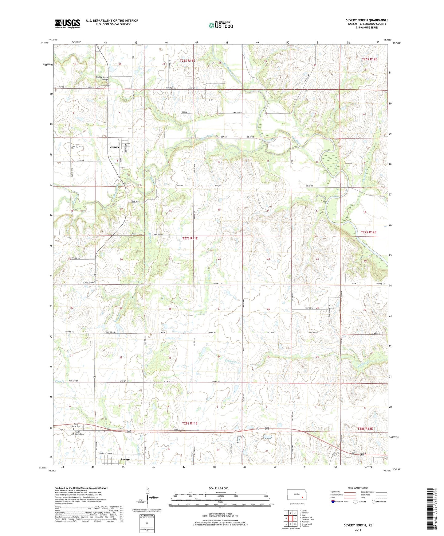
2022 topographic map quadrangle Severy North in the state of Kansas. Scale: 1:24000. Based on the newly updated USGS 7.5' US Topo map series, this map is in the following counties: Greenwood. The map contains contour data, water features, and other items you are used to seeing on USGS maps, but also has updated roads and other features. This is the next generation of topographic maps. Printed on high-quality waterproof paper with UV fade-resistant inks.
Quads adjacent to this one:
West: Piedmont NE
Northwest: Eureka
North: Tonovay
Northeast: Neal
East: Fall River Lake
Southeast: Fall River
South: Severy South
Southwest: Piedmont
This map covers the same area as the classic USGS quad with code o37096f2.
Contains the following named places: Batton School, City of Climax, Climax, Durham Creek, Economy School, Honey Creek, Honey Creek Bridge, Kansas Department of Wildlife and Parks Fall River Wildlife Division, Otter Creek, Pleasant View School, Prairie de Chene School, Snake Creek, South Lawn Cemetery, Sunflower Grange Hall, Township of Fall River, Township of Twin Grove, Twin Falls, Twin Grove Cemetery, ZIP Code: 67137