MyTopo
Neal Kansas US Topo Map
Couldn't load pickup availability
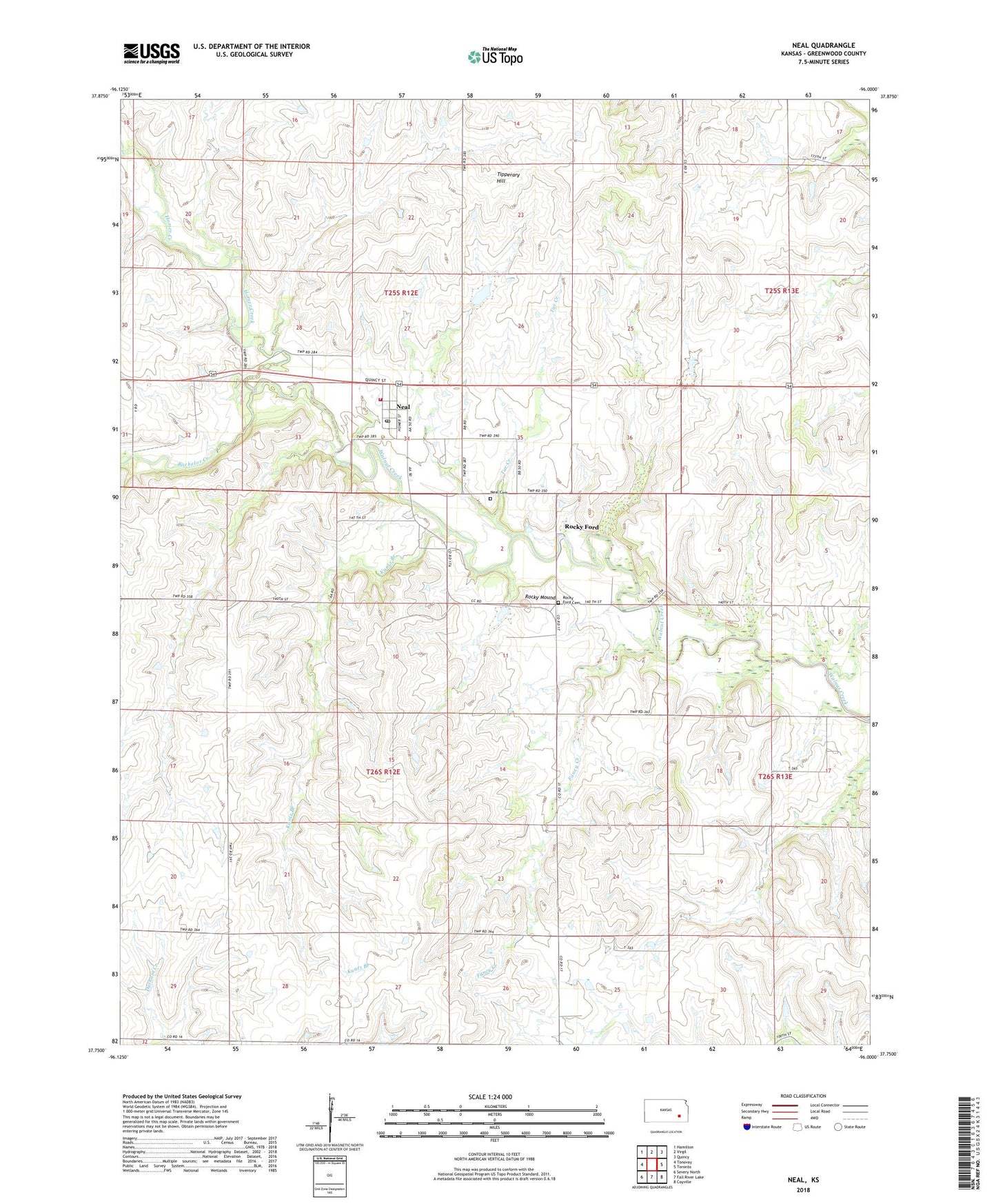
2022 topographic map quadrangle Neal in the state of Kansas. Scale: 1:24000. Based on the newly updated USGS 7.5' US Topo map series, this map is in the following counties: Greenwood. The map contains contour data, water features, and other items you are used to seeing on USGS maps, but also has updated roads and other features. This is the next generation of topographic maps. Printed on high-quality waterproof paper with UV fade-resistant inks.
Quads adjacent to this one:
West: Tonovay
Northwest: Hamilton
North: Virgil
Northeast: Quincy
East: Toronto
Southeast: Coyville
South: Fall River Lake
Southwest: Severy North
This map covers the same area as the classic USGS quad with code o37096g1.
Contains the following named places: Bachelor Creek, Fancy Community Hall, Fancy Creek, Fancy Oil Field, Kuntz Branch, Neal, Neal Cemetery, Neal Census Designated Place, Neal Evangelical Free Church, Neal Post Office, Neal Volunteer Fire Department, Rocky Ford, Rocky Ford Cemetery, Rocky Mound, Tar Creek, Tipperary Hill, Township of Pleasant Grove, Township of Quincy, ZIP Code: 66863