MyTopo
Fall River Lake Kansas US Topo Map
Couldn't load pickup availability
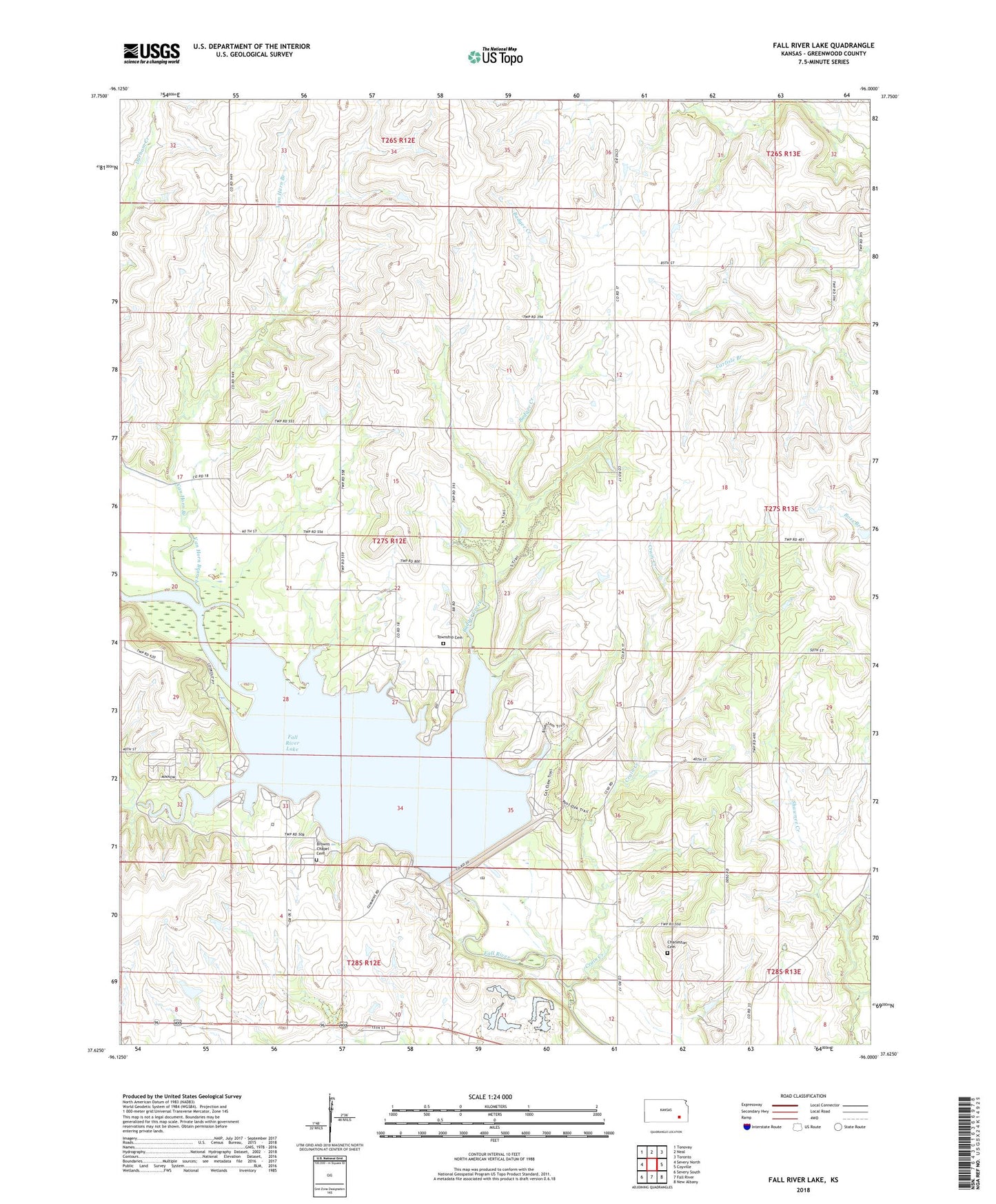
2022 topographic map quadrangle Fall River Lake in the state of Kansas. Scale: 1:24000. Based on the newly updated USGS 7.5' US Topo map series, this map is in the following counties: Greenwood. The map contains contour data, water features, and other items you are used to seeing on USGS maps, but also has updated roads and other features. This is the next generation of topographic maps. Printed on high-quality waterproof paper with UV fade-resistant inks.
Quads adjacent to this one:
West: Severy North
Northwest: Tonovay
North: Neal
Northeast: Toronto
East: Coyville
Southeast: New Albany
South: Fall River
Southwest: Severy South
This map covers the same area as the classic USGS quad with code o37096f1.
Contains the following named places: Badger Creek, Browns Chapel Cemetery, Burkton School, Casner Creek, Charleston, Charleston Cemetery, Charleston School, Crain Creek, Dudgeon School, Fall River Dam, Fall River Lake, Fall River Lake Fire Department, Fall River State Park, Fall River State Park Casner Creek Campground, Fall River State Park Fredonia Bay Campground, Fall River State Park Gobbler's Knob Campground, Fall River State Park Quarry Bay Campground, Fall River State Park South Rock Camping Area, Fall River Wildlife Area, Greenwood School, Heir Airport, Hickman, Hillside School, Pike Cemetery, Rock Ridge School, Township Cemetery, Township of Salt Springs, Van Horn Branch, Ward School, Whitehall School, ZIP Code: 67047