MyTopo
Solomon Rapids Kansas US Topo Map
Couldn't load pickup availability
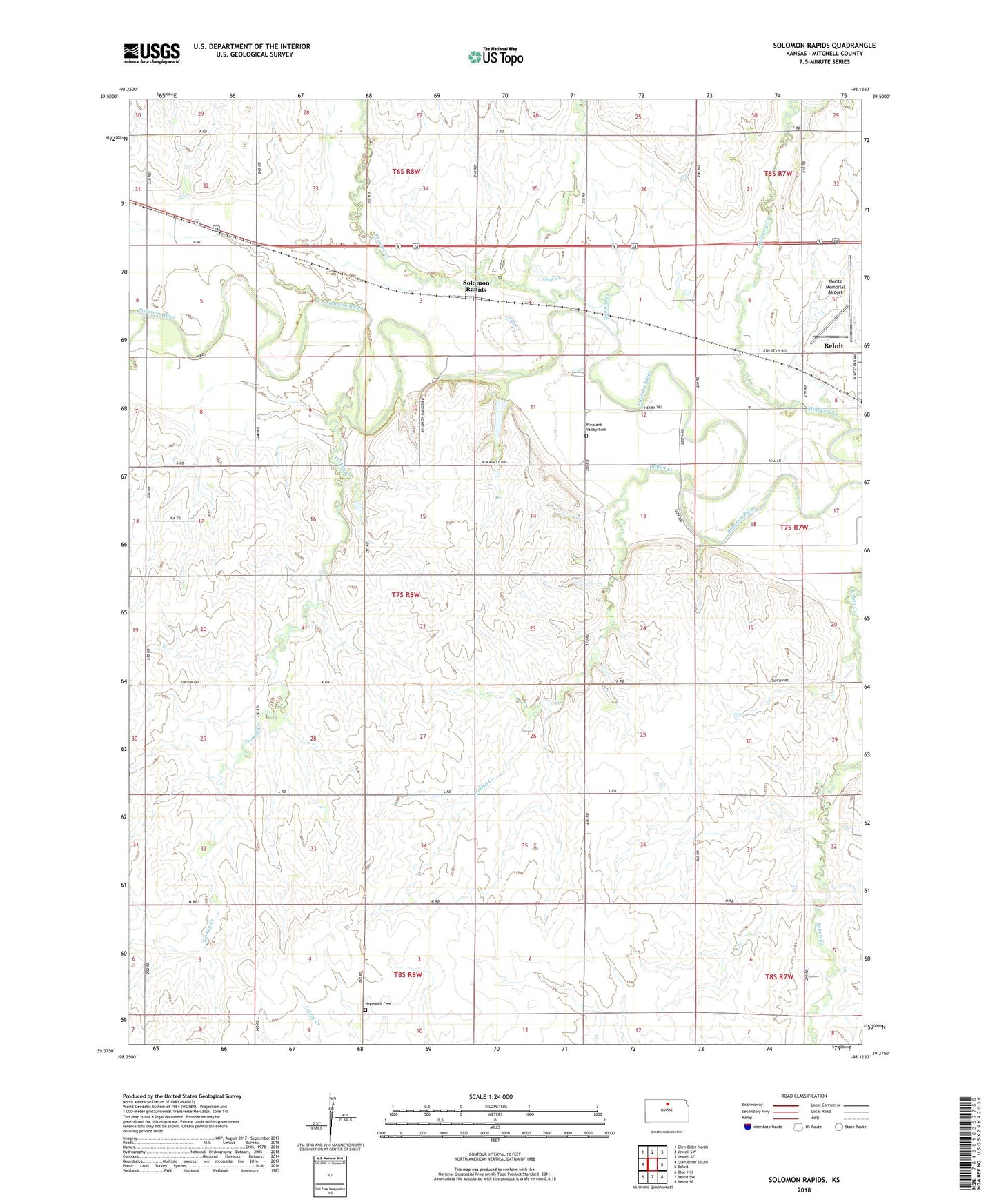
2022 topographic map quadrangle Solomon Rapids in the state of Kansas. Scale: 1:24000. Based on the newly updated USGS 7.5' US Topo map series, this map is in the following counties: Mitchell. The map contains contour data, water features, and other items you are used to seeing on USGS maps, but also has updated roads and other features. This is the next generation of topographic maps. Printed on high-quality waterproof paper with UV fade-resistant inks.
Quads adjacent to this one:
West: Glen Elder South
Northwest: Glen Elder North
North: Jewell SW
Northeast: Jewell SE
East: Beloit
Southeast: Beloit SE
South: Beloit SW
Southwest: Blue Hill
This map covers the same area as the classic USGS quad with code o39098d2.
Contains the following named places: Agmark Grain Elevator Number 17, Browns Creek, Dog Creek, Honey Creek School, Hopewell Cemetery, Hopewell Church, Humphrey School, Indian Creek, Mitchell County, Mitchell County Rural Fire District 3 Station A, Moritz Memorial Airport, Mulberry Creek, Pleasant Valley Cemetery, Roundtop School, Solomon Rapids, Solomon Rapids School, Township of Turkey Creek, Turkey Creek, Turkey Creek School