MyTopo
Glen Elder North Kansas US Topo Map
Couldn't load pickup availability
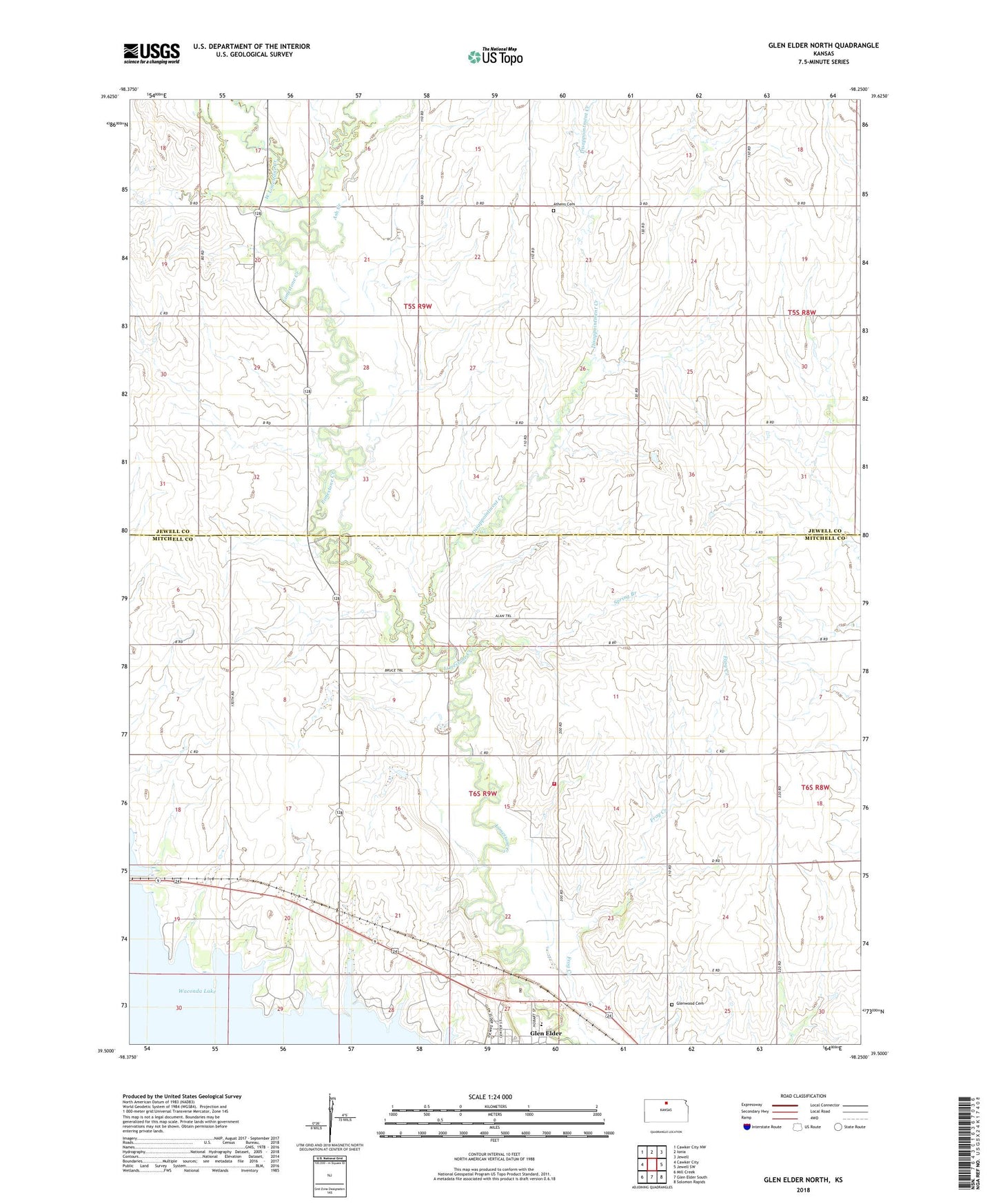
2022 topographic map quadrangle Glen Elder North in the state of Kansas. Scale: 1:24000. Based on the newly updated USGS 7.5' US Topo map series, this map is in the following counties: Jewell, Mitchell. The map contains contour data, water features, and other items you are used to seeing on USGS maps, but also has updated roads and other features. This is the next generation of topographic maps. Printed on high-quality waterproof paper with UV fade-resistant inks.
Quads adjacent to this one:
West: Cawker City
Northwest: Cawker City NW
North: Ionia
Northeast: Jewell
East: Jewell SW
Southeast: Solomon Rapids
South: Glen Elder South
Southwest: Mill Creek
This map covers the same area as the classic USGS quad with code o39098e3.
Contains the following named places: Ash Creek, Athens, Athens Cemetery, Athens School, City of Glen Elder, Disappointment Creek, Glen Elder Christian Church, Glen Elder Friends Church, Glen Elder State Park, Glen Elder State Park Arikaree Campground, Glen Elder State Park Cheyenne Campground, Glen Elder State Park Kanza Campground, Glen Elder State Park Kaw Campground, Glen Elder State Park Kiowa Campground, Glen Elder State Park Osage Campground, Glen Elder State Park Rangers Office, Glen Elder State Park Sioux Campground, Glen Elder State Park Uskuts Campground, Glen Elder State Park Visitors Center, Glenwood Cemetery, Hermes Creek, Lakeside Elementary School - Glen Elder, Mitchell County Rural Fire District 3 Station C, Spring Branch, Township of Athens, Township of Glen Elder, West Limestone Creek