MyTopo
Spring Hill Kansas US Topo Map
Couldn't load pickup availability
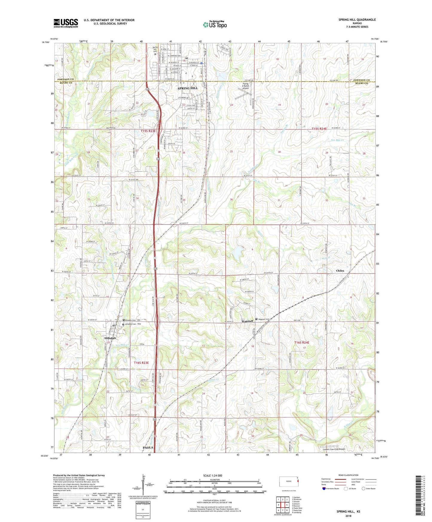
2022 topographic map quadrangle Spring Hill in the state of Kansas. Scale: 1:24000. Based on the newly updated USGS 7.5' US Topo map series, this map is in the following counties: Miami, Johnson. The map contains contour data, water features, and other items you are used to seeing on USGS maps, but also has updated roads and other features. This is the next generation of topographic maps. Printed on high-quality waterproof paper with UV fade-resistant inks.
Quads adjacent to this one:
West: Antioch
Northwest: Gardner
North: Ocheltree
Northeast: Stilwell
East: Bucyrus
Southeast: Louisburg
South: Paola East
Southwest: Paola West
This map covers the same area as the classic USGS quad with code o38094f7.
Contains the following named places: Beverly Health and Rehabilitation Center of Spring Hill, Blackhawk Retail Center, Chiles, Cottonwood Creek, Drummond Branch, Elm Branch, Farmers Union Co - Operative Company Grain Elevator Number 1, Flying Z Ranch Airport, Glendale School, Hillsdale, Hillsdale Cemetery - New, Hillsdale Cemetery - Old, Hillsdale Census Designated Place, Hillsdale Elementary School, Hillsdale Post Office, Hillsdale Presbyerian Church, Insight School of Kansas, Jubilee Family Ministry Center, Life Spring Church, Linders Cow-Chip Airport, Pleasant Ridge School, Shannon Square Shopping Center, Sixmile Creek, Southside Baptist Church, Spring Creek, Spring Hill, Spring Hill Baptist Church, Spring Hill Cemetery, Spring Hill Church of Christ, Spring Hill City Hall, Spring Hill Elementary School, Spring Hill Intermediate School, Spring Hill Library, Spring Hill Middle School, Spring Hill Plaza Shopping Center, Spring Hill Police Department, Spring Hill Post Office, Spring Hill School District Ofices, Spring Hill United Methodist Church, Spring Hill Wastewater Treatment Facility, Sweetwater Creek, Ten Mile, Township of Marysville, Township of Ten Mile, Trinity Lutheran School, Tucker Branch, Wagstaff, Wagstaff Cemetery, Wagstaff Lake, Weiss Airport, Wolf Creek, ZIP Code: 66083