MyTopo
Louisburg Kansas US Topo Map
Couldn't load pickup availability
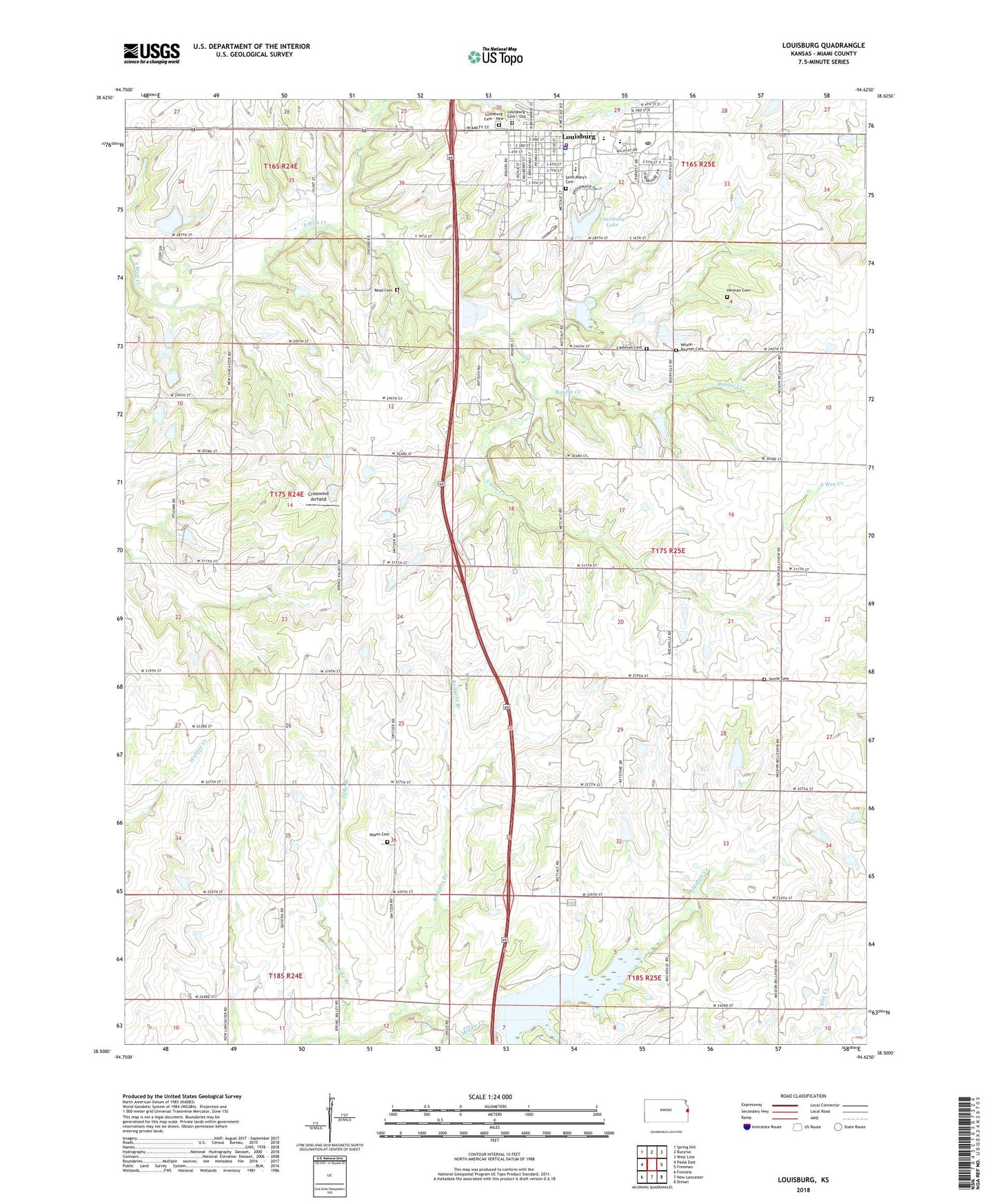
2022 topographic map quadrangle Louisburg in the state of Kansas. Scale: 1:24000. Based on the newly updated USGS 7.5' US Topo map series, this map is in the following counties: Miami. The map contains contour data, water features, and other items you are used to seeing on USGS maps, but also has updated roads and other features. This is the next generation of topographic maps. Printed on high-quality waterproof paper with UV fade-resistant inks.
Quads adjacent to this one:
West: Paola East
Northwest: Spring Hill
North: Bucyrus
Northeast: West Line
East: Freeman
Southeast: Drexel
South: New Lancaster
Southwest: Fontana
This map covers the same area as the classic USGS quad with code o38094e6.
Contains the following named places: Baxter School, Bellview School, Broadmoor Elementary School, Cashman Cemetery, Centennial School, Christ Our Savior Lutheran Church, Circle Grove Elementary School, City of Louisburg, Crosswind Airfield, First Baptist Church, First Christian Church, Fox Hall Community Building, Herman Cemetery, Immaculate Conception Catholic Church, Jake Branch, Louisburg, Louisburg Aquatic Center, Louisburg Cemetery, Louisburg Cemetery - New, Louisburg City Dam, Louisburg City Hall, Louisburg Fire Department, Louisburg High School, Louisburg Lake, Louisburg Library, Louisburg Middle School, Louisburg Municipal Wastewater Treatment Plant Number 1, Louisburg Police Department, Louisburg Post Office, Louisburg Unified School District Office, Louisburg United Methodist Church, Louisburg Wastewater Treatment Plant Number 2, McNelly School, Metcalf Ridge Country Course, Miami Cemetery, Miami Emergency Medical Services Station 2, Miami Presbyterian Church, Moore School, Peoria Street Learning Center, Rabbit Creek, Reed Cemetery, Rodgers Branch, Rutlader Outpost Camping Facility, Saint Mary's Cemetery, Settle Cemetery, Somerset Airport, Spring Valley School, Township of Middle Creek, Wilson - Raymer Cemetery, ZIP Code: 66053