MyTopo
Thrall Kansas US Topo Map
Couldn't load pickup availability
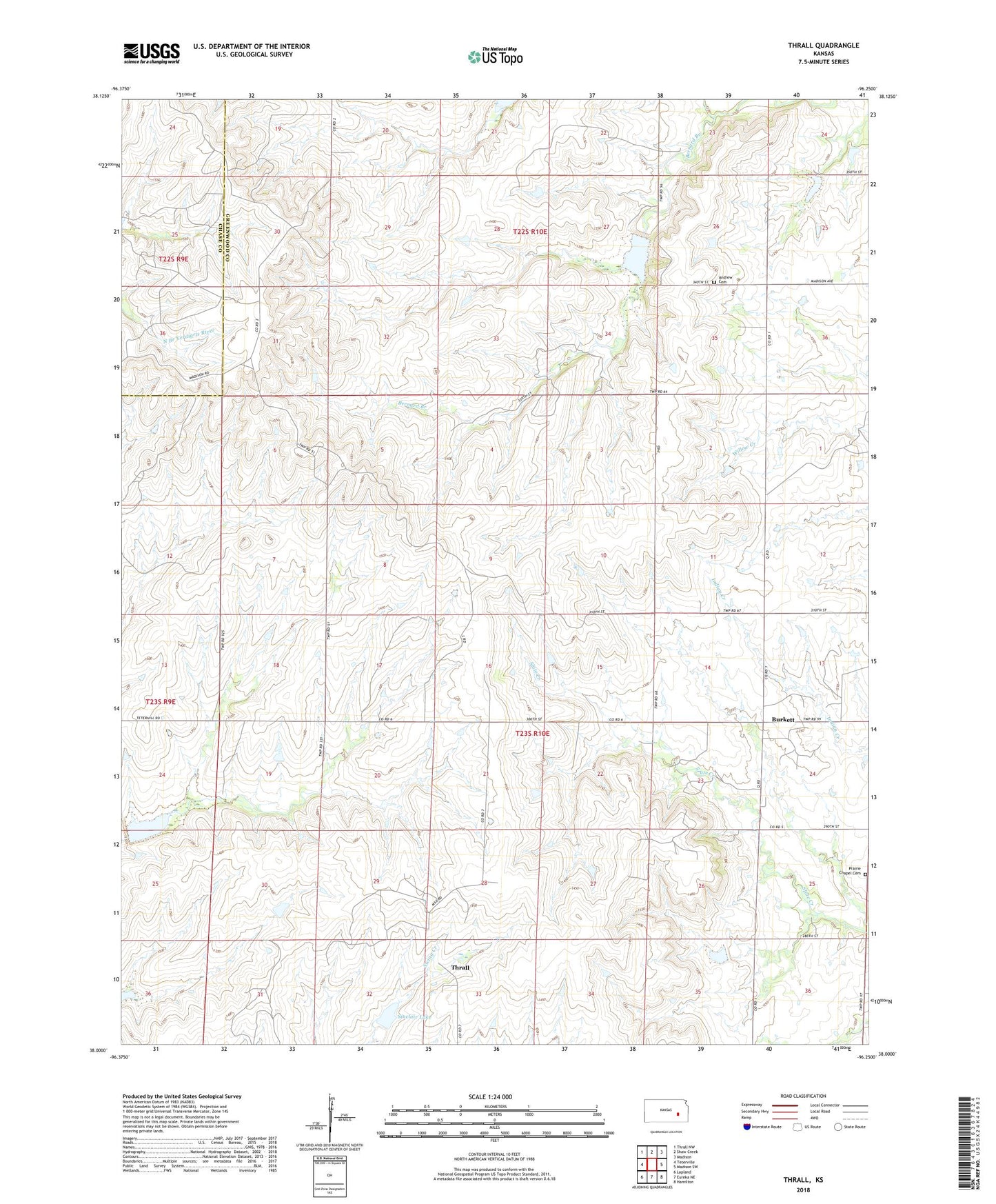
2022 topographic map quadrangle Thrall in the state of Kansas. Scale: 1:24000. Based on the newly updated USGS 7.5' US Topo map series, this map is in the following counties: Greenwood, Chase. The map contains contour data, water features, and other items you are used to seeing on USGS maps, but also has updated roads and other features. This is the next generation of topographic maps. Printed on high-quality waterproof paper with UV fade-resistant inks.
Quads adjacent to this one:
West: Teterville
Northwest: Thrall NW
North: Shaw Creek
Northeast: Madison
East: Madison SW
Southeast: Hamilton
South: Eureka NE
Southwest: Lapland
This map covers the same area as the classic USGS quad with code o38096a3.
Contains the following named places: Andrew Cemetery, Bernard Branch, Browning Oil Field, Burkett, Burkett Oil Field, Prairie Chapel Cemetery, Sinclair Lake, Thrall, Zimmermann Oil Field