MyTopo
Trenton Kansas US Topo Map
Couldn't load pickup availability
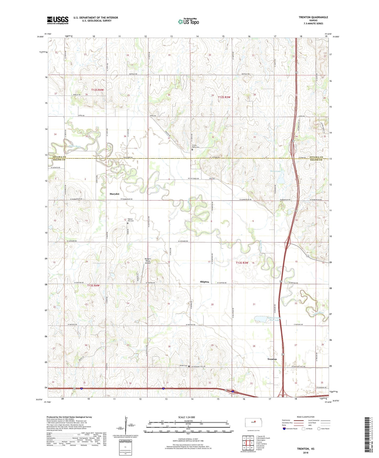
2022 topographic map quadrangle Trenton in the state of Kansas. Scale: 1:24000. Based on the newly updated USGS 7.5' US Topo map series, this map is in the following counties: Saline, Ottawa. The map contains contour data, water features, and other items you are used to seeing on USGS maps, but also has updated roads and other features. This is the next generation of topographic maps. Printed on high-quality waterproof paper with UV fade-resistant inks.
Quads adjacent to this one:
West: Culver
Northwest: Tescott SE
North: Minneapolis South
Northeast: Bennington
East: New Cambria
Southeast: Salina
South: Salina SW
Southwest: Brookville
This map covers the same area as the classic USGS quad with code o38097h6.
Contains the following named places: Burger's Valley Airport, Crown Point, Crown Point Cemetery, Kansas Department of Transportation Ottawa County Rest Area, KSAL - FM (Salina), Lockard School, Marydel, Saline County State Lake, Saline County State Lake Dam, Shiloh Cemetery, Shiloh School, Shipton, Township of Elm Creek, Trenton, Walnut Grove Cemetery, Wary Lake