MyTopo
Minneapolis South Kansas US Topo Map
Couldn't load pickup availability
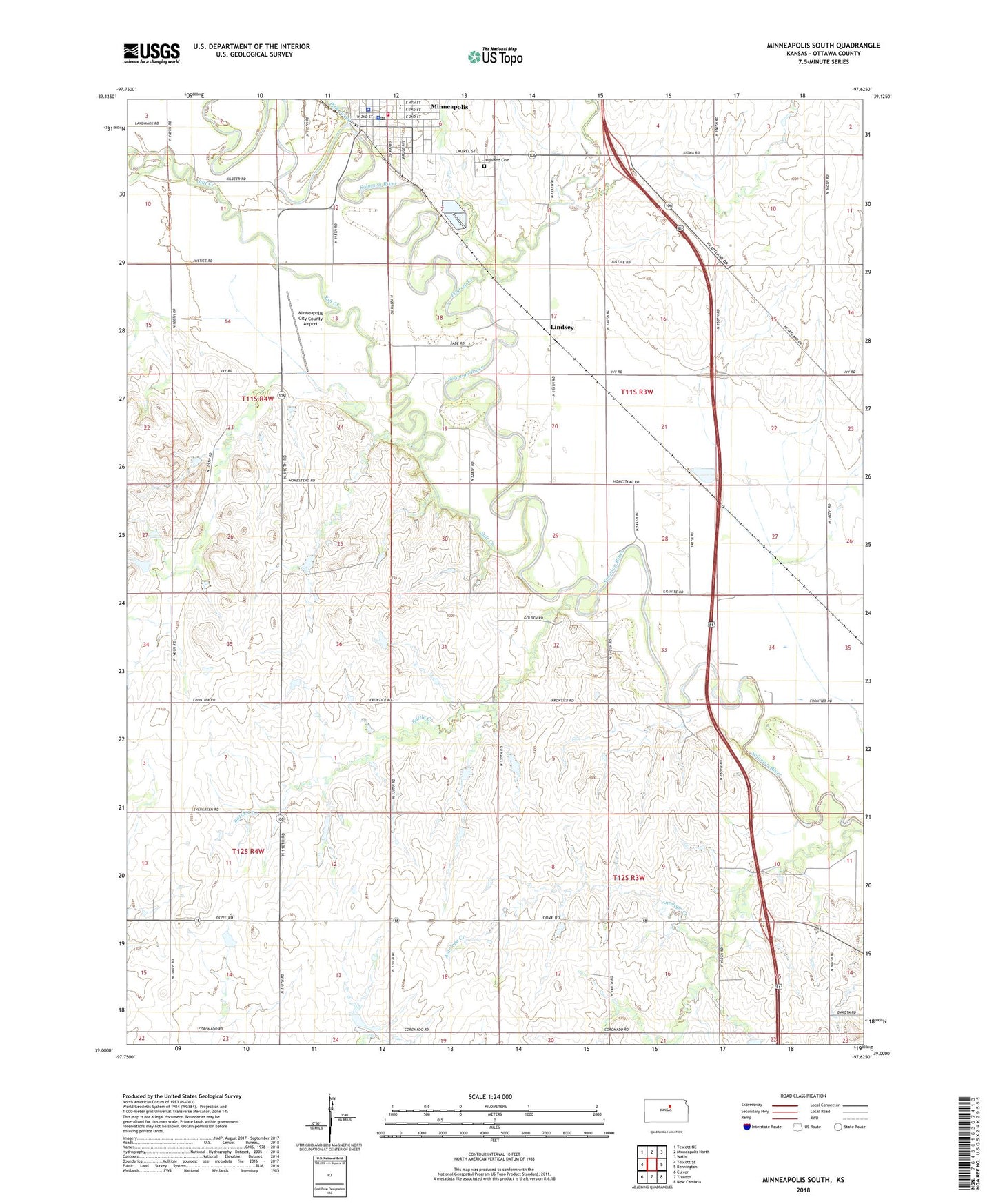
2022 topographic map quadrangle Minneapolis South in the state of Kansas. Scale: 1:24000. Based on the newly updated USGS 7.5' US Topo map series, this map is in the following counties: Ottawa. The map contains contour data, water features, and other items you are used to seeing on USGS maps, but also has updated roads and other features. This is the next generation of topographic maps. Printed on high-quality waterproof paper with UV fade-resistant inks.
Quads adjacent to this one:
West: Tescott SE
Northwest: Tescott NE
North: Minneapolis North
Northeast: Wells
East: Bennington
Southeast: New Cambria
South: Trenton
Southwest: Culver
This map covers the same area as the classic USGS quad with code o39097a6.
Contains the following named places: Ada Grain Company Grain Elevator Number 2, Battle Creek, City of Minneapolis, First Baptist Church, First Presbyterian Church, Highland Cemetery, Immaculate Conception Catholic Church, KZUH - FM (Salina), Lindsey, Lindsey Creek, Minneapolis, Minneapolis Ambulance Service, Minneapolis Area Chamber of Commerce, Minneapolis Church of the Nazarene, Minneapolis City County Airport, Minneapolis City Hall, Minneapolis Fairgrounds, Minneapolis Golf Course, Minneapolis Grade School, Minneapolis Police Department, Minneapolis Post Office, Minneapolis Raceway Park, Minneapolis United Methodist Church, Minneapolis Wastewater Treatment Facility, Ottawa County Courthouse, Ottawa County Detention Center, Ottawa County Historical Museum, Ottawa County Rural Fire Department Station 2 Minneapolis, Ottawa County Sheriff's Office, Pipe Creek, Rock City, Salt Creek, Solomon Valley Airpark, Township of Bennington, Township of Concord