MyTopo
Bennington Kansas US Topo Map
Couldn't load pickup availability
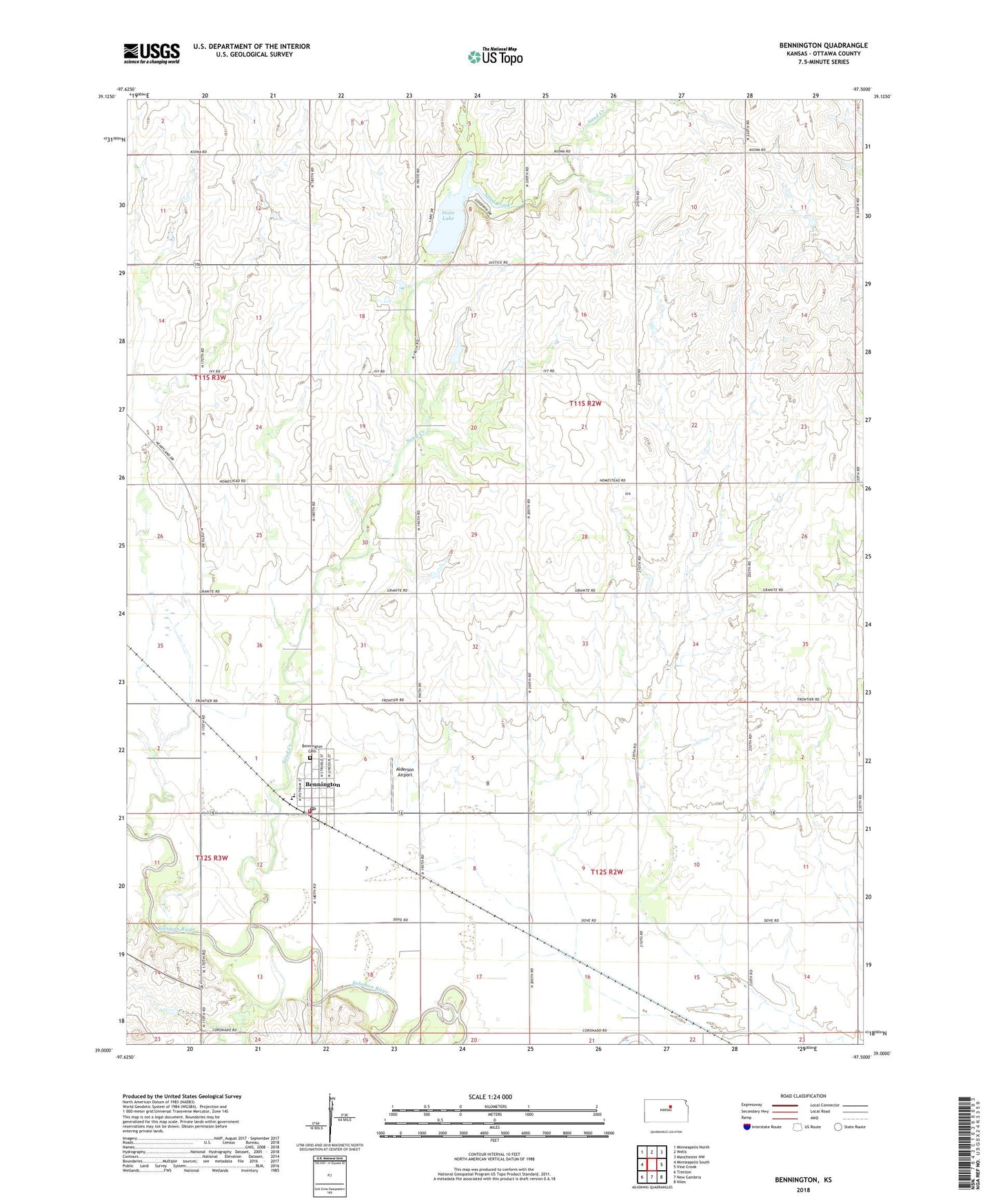
2022 topographic map quadrangle Bennington in the state of Kansas. Scale: 1:24000. Based on the newly updated USGS 7.5' US Topo map series, this map is in the following counties: Ottawa. The map contains contour data, water features, and other items you are used to seeing on USGS maps, but also has updated roads and other features. This is the next generation of topographic maps. Printed on high-quality waterproof paper with UV fade-resistant inks.
Quads adjacent to this one:
West: Minneapolis South
Northwest: Minneapolis North
North: Wells
Northeast: Manchester NW
East: Vine Creek
Southeast: Niles
South: New Cambria
Southwest: Trenton
This map covers the same area as the classic USGS quad with code o39097a5.
Contains the following named places: Alderson Airport, Antelope Creek, Bennington, Bennington Ambulance Service, Bennington Bible Church, Bennington Cemetery, Bennington Elementary School, Bennington Junior / Senior High School, Bennington Post Office, Bennington Wastewater Plant, Berkley Airport, City of Bennington, Episcopal Church of the Transfiguration, Ottawa County Fire District 4 Bennington, Ottawa County State Lake Dam, Ottawa County State Park, Ottawa State Fishing Lake and Wildlife Area, Sand Creek, State Lake, Team Marketing Alliance Grain Elevator Number 41, Township of Buckeye, Township of Richland, United Church of Bennington, ZIP Code: 67422