MyTopo
Webster Dam Kansas US Topo Map
Couldn't load pickup availability
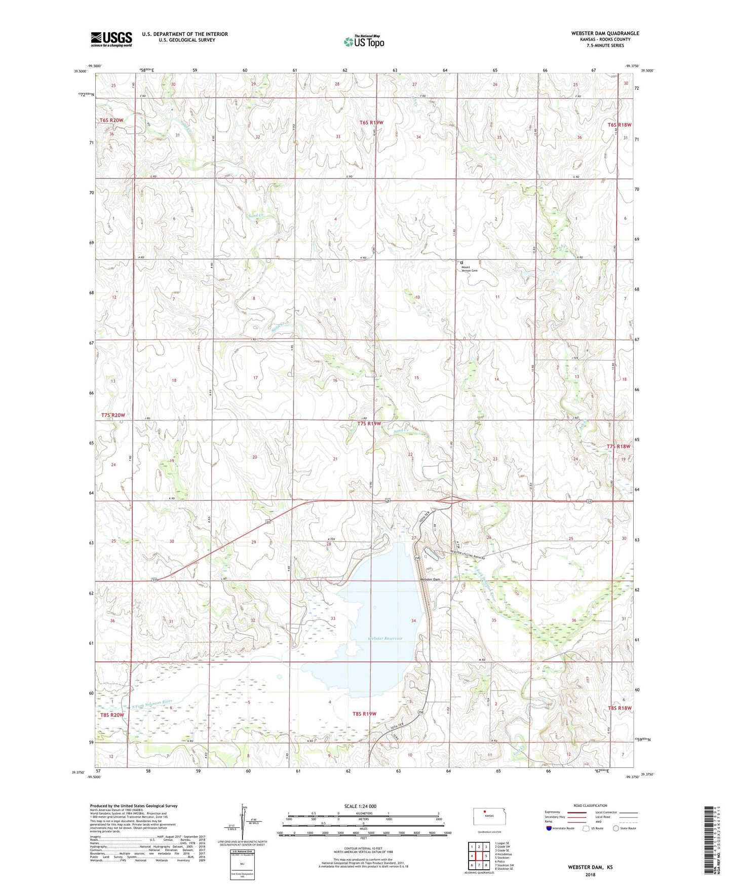
2022 topographic map quadrangle Webster Dam in the state of Kansas. Scale: 1:24000. Based on the newly updated USGS 7.5' US Topo map series, this map is in the following counties: Rooks. The map contains contour data, water features, and other items you are used to seeing on USGS maps, but also has updated roads and other features. This is the next generation of topographic maps. Printed on high-quality waterproof paper with UV fade-resistant inks.
Quads adjacent to this one:
West: Nicodemus
Northwest: Logan SE
North: Glade SW
Northeast: Glade SE
East: Stockton
Southeast: Stockton SE
South: Stockton SW
Southwest: Palco
This map covers the same area as the classic USGS quad with code o39099d4.
Contains the following named places: Lost Creek, Mount Vernon Cemetery, Mount Vernon Community Hall, Sand Creek, Township 6, Webster, Webster Cemetery, Webster Dam, Webster Reservoir Airstrip, Webster State Park, Webster State Park Canada Campground, Webster State Park Eagle Landing Campground, Webster State Park Lake View Camping Area, Webster State Park Law Enforcement, Webster State Park Marina Point Campground, Webster State Park Mushroom Camping Area, Webster State Park Office Building, Webster State Park Old Marina Campground, Webster State Park Rock Point Campground