MyTopo
Westmoreland Kansas US Topo Map
Couldn't load pickup availability
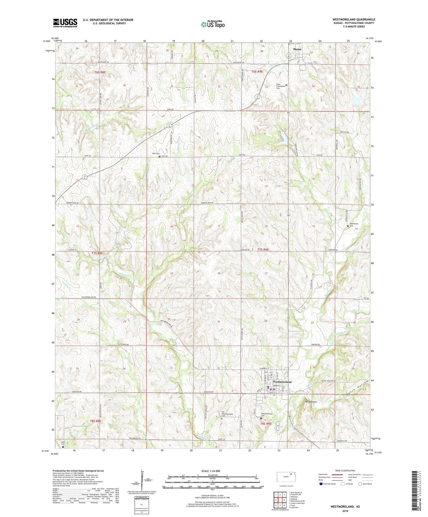
2022 topographic map quadrangle Westmoreland in the state of Kansas. Scale: 1:24000. Based on the newly updated USGS 7.5' US Topo map series, this map is in the following counties: Pottawatomie. The map contains contour data, water features, and other items you are used to seeing on USGS maps, but also has updated roads and other features. This is the next generation of topographic maps. Printed on high-quality waterproof paper with UV fade-resistant inks.
Quads adjacent to this one:
West: Olsburg
Northwest: Blue Rapids SE
North: Frankfort SW
Northeast: Wheaton
East: Westmoreland NE
Southeast: Louisville
South: Flush
Southwest: Tuttle Creek Dam
This map covers the same area as the classic USGS quad with code o39096d4.
Contains the following named places: Blaine, City of Westmoreland, Darnells Creek, Dutch Hollow, Huff Cemetery, Moodyville, Moodyville Cemetery, Mount Calvary Catholic Cemetery, Mount Ephraim, Old Westmoreland Cemetery, Pottawatomie County Courthouse, Pottawatomie County Health Department, Pottawatomie County Jail, Pottawatomie County Sheriff's Office, Pottawatomie County State Park Number One, Pottawatomie Number One State Fishing Lake and Wildlife Area, Pottawatomie Wabaunsee Regional Library Westmoreland Mini Branch, Rock Creek Unified School District Office, Rock Creek Valley Historical Society Museum, Sales Cemetery, Scott Spring, Seven Township and Westmoreland Fire Department, Township of Rock Creek, Westmoreland, Westmoreland Cemetery, Westmoreland City Hall, Westmoreland Elementary School, Westmoreland Post Office, Westmoreland Wastewater Treatment Facility, ZIP Code: 66549