MyTopo
Tuttle Creek Dam Kansas US Topo Map
Couldn't load pickup availability
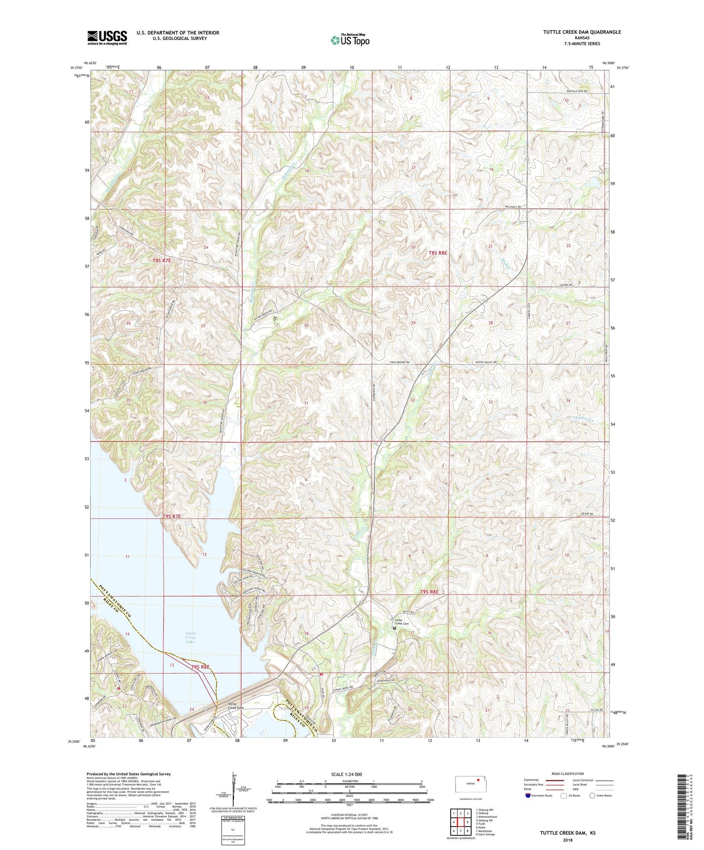
2022 topographic map quadrangle Tuttle Creek Dam in the state of Kansas. Scale: 1:24000. Based on the newly updated USGS 7.5' US Topo map series, this map is in the following counties: Pottawatomie, Riley. The map contains contour data, water features, and other items you are used to seeing on USGS maps, but also has updated roads and other features. This is the next generation of topographic maps. Printed on high-quality waterproof paper with UV fade-resistant inks.
Quads adjacent to this one:
West: Olsburg SW
Northwest: Olsburg NW
North: Olsburg
Northeast: Westmoreland
East: Flush
Southeast: Saint George
South: Manhattan
Southwest: Keats
This map covers the same area as the classic USGS quad with code o39096c5.
Contains the following named places: Blue Township Fire Department Station 2, Cedar Creek Cemetery, McIntire Creek, Riley County Fire District 1 Station 12, Spillway State Park, Township of Green, Tuttle Creek Dam, Tuttle Creek State Park, Tuttle Creek State Park Rangers Office, Tuttle Creek State Park River Pond Campground