MyTopo
Wilson NE Kansas US Topo Map
Couldn't load pickup availability
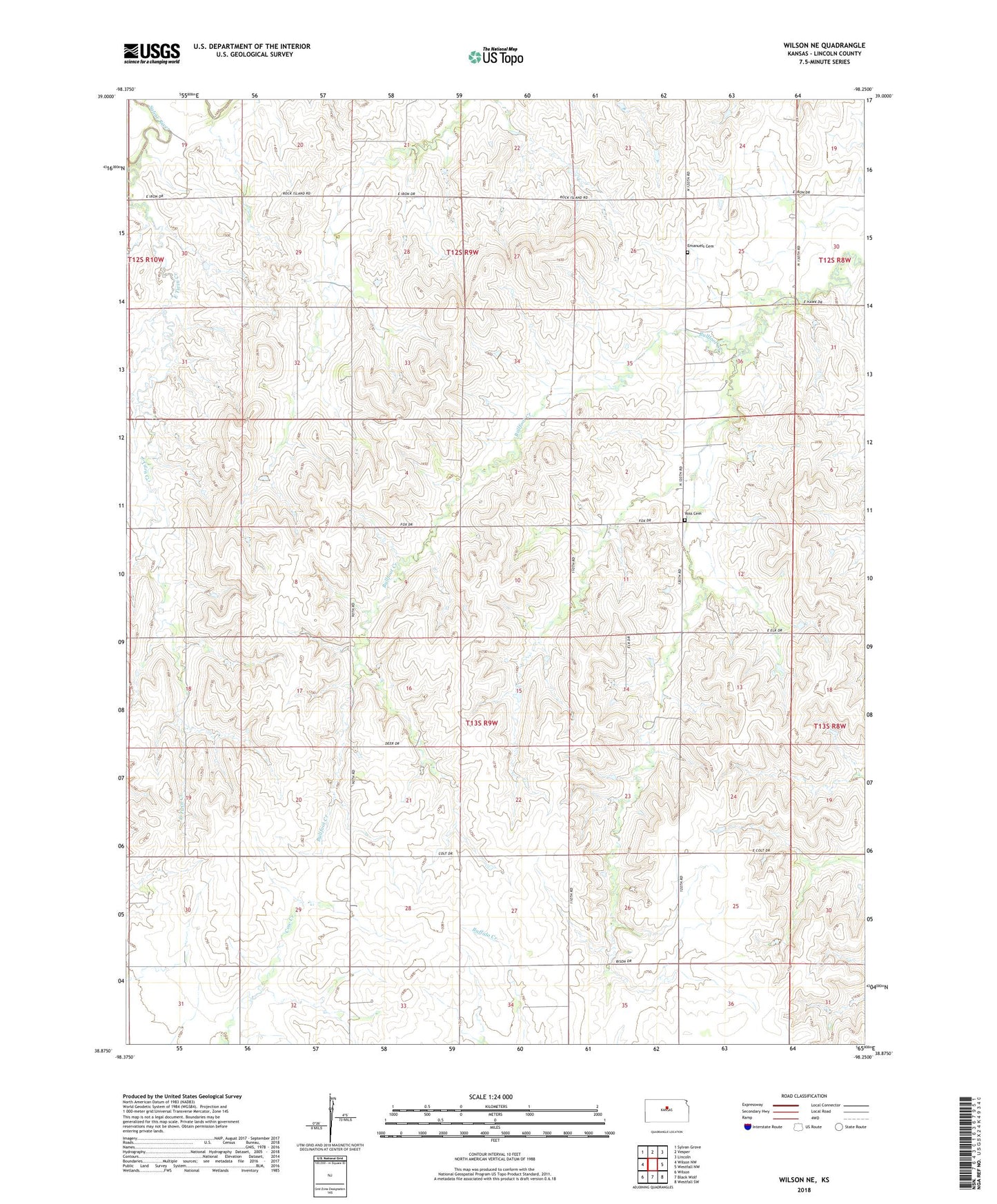
2022 topographic map quadrangle Wilson NE in the state of Kansas. Scale: 1:24000. Based on the newly updated USGS 7.5' US Topo map series, this map is in the following counties: Lincoln. The map contains contour data, water features, and other items you are used to seeing on USGS maps, but also has updated roads and other features. This is the next generation of topographic maps. Printed on high-quality waterproof paper with UV fade-resistant inks.
Quads adjacent to this one:
West: Wilson NW
Northwest: Sylvan Grove
North: Vesper
Northeast: Lincoln
East: Westfall NW
Southeast: Westfall SW
South: Black Wolf
Southwest: Wilson
This map covers the same area as the classic USGS quad with code o38098h3.
Contains the following named places: East Twin Creek, Emanuel Cemetery, Emmanuel United Church of Christ, Margaret, Margaret School, Township of Golden Belt, Voss Cemetery