MyTopo
Vesper Kansas US Topo Map
Couldn't load pickup availability
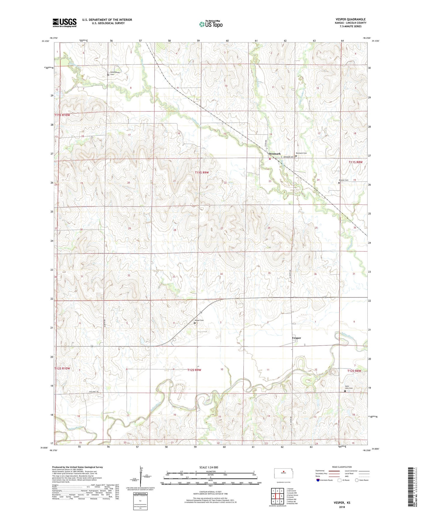
2022 topographic map quadrangle Vesper in the state of Kansas. Scale: 1:24000. Based on the newly updated USGS 7.5' US Topo map series, this map is in the following counties: Lincoln. The map contains contour data, water features, and other items you are used to seeing on USGS maps, but also has updated roads and other features. This is the next generation of topographic maps. Printed on high-quality waterproof paper with UV fade-resistant inks.
Quads adjacent to this one:
West: Sylvan Grove
Northwest: Hunter
North: Ash Grove
Northeast: Lincoln NW
East: Lincoln
Southeast: Westfall NW
South: Wilson NE
Southwest: Wilson NW
This map covers the same area as the classic USGS quad with code o39098a3.
Contains the following named places: Agmark Grain Elevator Number 19, Agmark Grain Elevator Number 6, Bacon Creek, Denmark, Denmark - Hunter Rural Fire Department, Denmark Lutheran Cemetery, Free Mission Cemetery, Grant, Little Timber Creek, Pottersburg, Pottersburg Cemetery, Saint John Cemetery, Township of Grant, Township of Vesper, Trail Creek, Vesper, Vesper Cemetery