MyTopo
Zenda Kansas US Topo Map
Couldn't load pickup availability
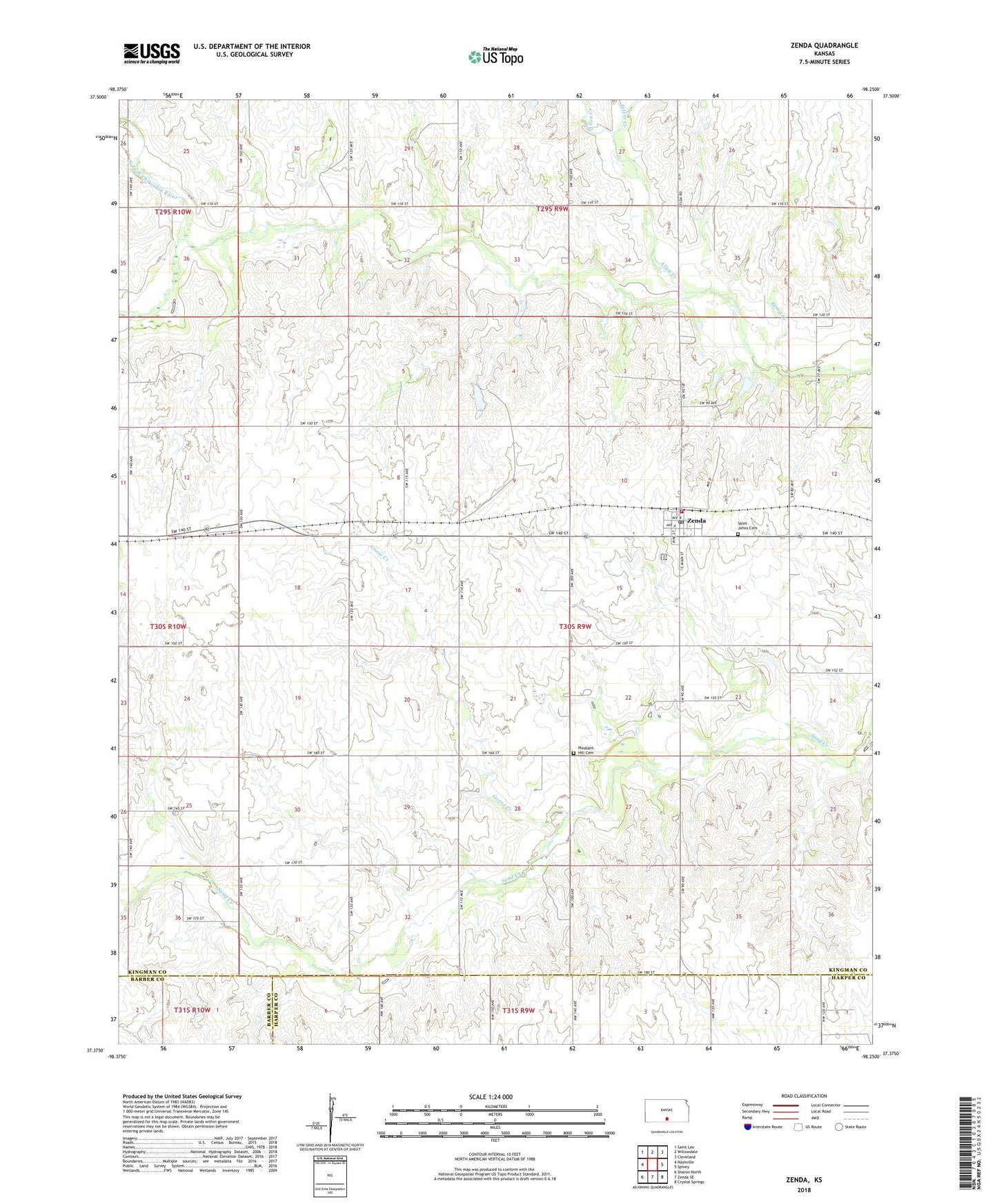
2022 topographic map quadrangle Zenda in the state of Kansas. Scale: 1:24000. Based on the newly updated USGS 7.5' US Topo map series, this map is in the following counties: Kingman, Harper, Barber. The map contains contour data, water features, and other items you are used to seeing on USGS maps, but also has updated roads and other features. This is the next generation of topographic maps. Printed on high-quality waterproof paper with UV fade-resistant inks.
Quads adjacent to this one:
West: Nashville
Northwest: Saint Leo
North: Willowdale
Northeast: Cleveland
East: Spivey
Southeast: Crystal Springs
South: Zenda SE
Southwest: Sharon North
This map covers the same area as the classic USGS quad with code o37098d3.
Contains the following named places: Allen Creek, Bross School, City of Zenda, Cross Creek, Goose Creek, Happy Hollow School, Kemp Creek, New Rochester, North Fork Chikaskia River, Peters Creek, Pleasant Hill Cemetery, Saint John's Catholic Church, Saint Johns Cemetery, Skunk Creek, Spring Creek School, Sunny View School, Township of Rochester, Westport, Zenda, Zenda Elementary School, Zenda Post Office, Zenda Public Library, Zenda Rural Fire Department, Zenda United Methodist Church, Zenda Wastewater Plant, ZIP Code: 67159