MyTopo
Saint Leo Kansas US Topo Map
Couldn't load pickup availability
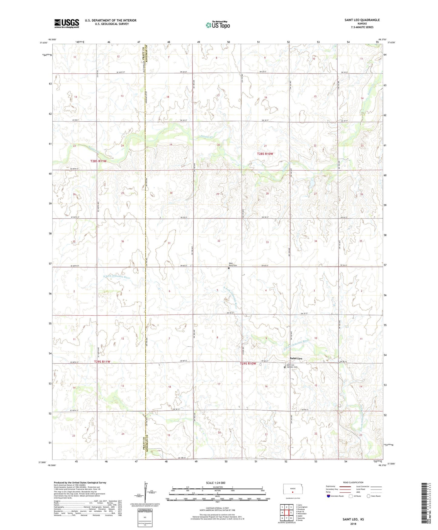
2022 topographic map quadrangle Saint Leo in the state of Kansas. Scale: 1:24000. Based on the newly updated USGS 7.5' US Topo map series, this map is in the following counties: Kingman, Pratt. The map contains contour data, water features, and other items you are used to seeing on USGS maps, but also has updated roads and other features. This is the next generation of topographic maps. Printed on high-quality waterproof paper with UV fade-resistant inks.
Quads adjacent to this one:
West: Pratt SE
Northwest: Cairo
North: Cunningham
Northeast: Penalosa
East: Willowdale
Southeast: Zenda
South: Nashville
Southwest: Isabel
This map covers the same area as the classic USGS quad with code o37098e4.
Contains the following named places: Maude School, Oklahoma, Saint Leo, Saint Leo Catholic Cemetery, Saint Leo School, Saint Leo the Great Catholic Church, Township of Kingman, Township of Rural, Valley School, West Point Cemetery, West Point School, White Mound School