MyTopo
Allen Springs Kentucky US Topo Map
Couldn't load pickup availability
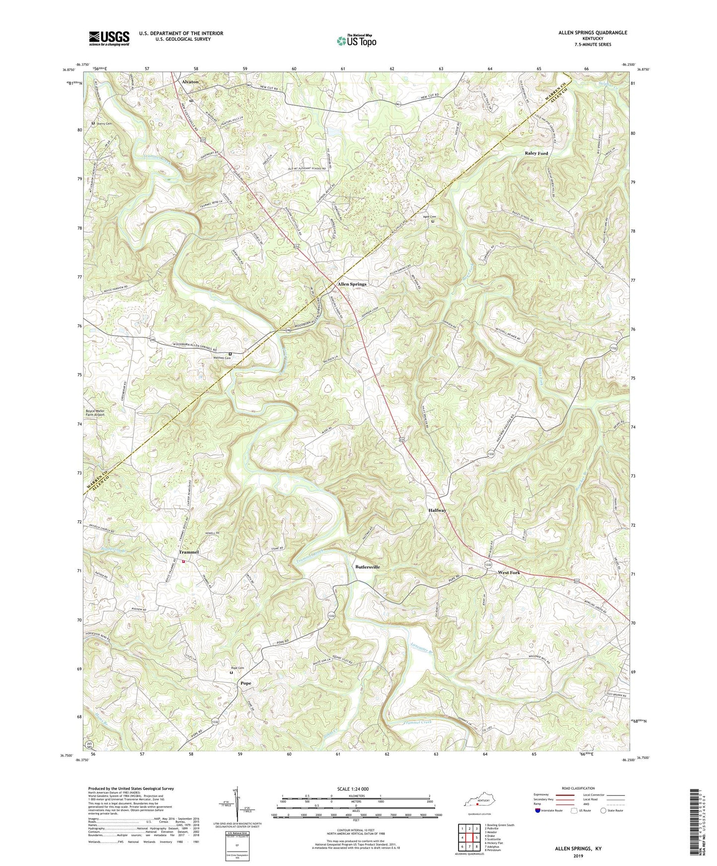
2022 topographic map quadrangle Allen Springs in the state of Kentucky. Scale: 1:24000. Based on the newly updated USGS 7.5' US Topo map series, this map is in the following counties: Allen, Warren. The map contains contour data, water features, and other items you are used to seeing on USGS maps, but also has updated roads and other features. This is the next generation of topographic maps. Printed on high-quality waterproof paper with UV fade-resistant inks.
Quads adjacent to this one:
West: Drake
Northwest: Bowling Green South
North: Polkville
Northeast: Meador
East: Scottsville
Southeast: Petroleum
South: Adolphus
Southwest: Hickory Flat
This map covers the same area as the classic USGS quad with code o36086g3.
Contains the following named places: Agee Cemetery, Allen Springs, Alvaton, Alvaton Post Office, Antioch Church, Bailey, Bailey School, Beech Grove General Baptist Church, Boucher Branch, Butlersville, Fairview Church, Friendship Church, Halfway, Halfway Division, Halfway School, Harmony School, Johns Creek, Lancaster Branch, Mount Pleasant School, Mount Union General Baptist Church, New Bethel Methodist Church, Old Liberty Church, Pope, Pope Cemetery, Raley Ford, Sherry Cemetery, Shiloh Church, Sulphur Creek, Trammel, Trammel Fork Missionary Baptist Church, Trammel Volunteer Fire Department, Walthall Cemetery, WBLG-FM (Smiths Grove), West Fork, ZIP Code: 42122