MyTopo
Polkville Kentucky US Topo Map
Couldn't load pickup availability
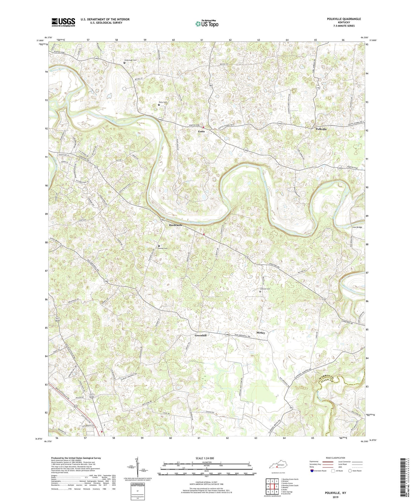
2022 topographic map quadrangle Polkville in the state of Kentucky. Scale: 1:24000. Based on the newly updated USGS 7.5' US Topo map series, this map is in the following counties: Warren, Allen. The map contains contour data, water features, and other items you are used to seeing on USGS maps, but also has updated roads and other features. This is the next generation of topographic maps. Printed on high-quality waterproof paper with UV fade-resistant inks.
Quads adjacent to this one:
West: Bowling Green South
Northwest: Bowling Green North
North: Bristow
Northeast: Smiths Grove
East: Meador
Southeast: Scottsville
South: Allen Springs
Southwest: Drake
This map covers the same area as the classic USGS quad with code o36086h3.
Contains the following named places: Alvaton Division, Alvaton School, Alvaton Volunteer Fire Department Station 1, Alvaton Volunteer Fire Department Station 2, Bays Fork Church, Berea Church, Bethany Church, Bethel Church, Cassidy Church, Collett, Drakes Creek, Gilmore Cemetery, Gott Volunteer Fire Department, Gotts, Greenhill, Hardcastle, Iron Bridge, Kimbrough Cemetery, Motley, Petty Cemetery, Pleasant Hill Church, Polkville, Rocky Springs School, Thomas Cemetery, Trammel Creek, ZIP Code: 42103