MyTopo
Amandaville Kentucky US Topo Map
Couldn't load pickup availability
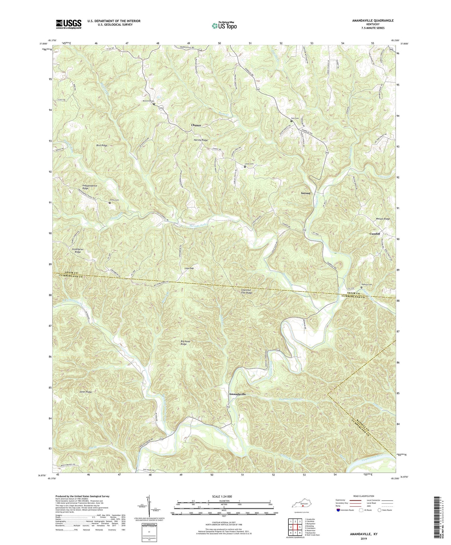
2022 topographic map quadrangle Amandaville in the state of Kentucky. Scale: 1:24000. Based on the newly updated USGS 7.5' US Topo map series, this map is in the following counties: Adair, Cumberland, Russell. The map contains contour data, water features, and other items you are used to seeing on USGS maps, but also has updated roads and other features. This is the next generation of topographic maps. Printed on high-quality waterproof paper with UV fade-resistant inks.
Quads adjacent to this one:
West: Breeding
Northwest: Gradyville
North: Columbia
Northeast: Montpelier
East: Creelsboro
Southeast: Wolf Creek Dam
South: Burkesville
Southwest: Waterview
This map covers the same area as the classic USGS quad with code o36085h3.
Contains the following named places: Amandaville, Big Pond Ridge, Bird Ridge, Burns Creek, Casey Fork, Cedar Creek, Chance, Chestnut Flat Ridge, Collins Branch, Concord Church, Cundiff, Doe Creek, Earl Cemetery, Elliott School, Glens Fork Division, Greenbrier School, Hadleys Cemetery, Harrods Fork, Harvey Branch, Harvey Ridge, Hogard Church, Hopewell Baptist Church, Independence Ridge, Inroad, Jones Ridge, Jones Ridge School, Lewis Cemetery, Low Gap, McGinnis Cemetery, Morgan School, Pine Branch, Powells Creek, Puncheon Camp Creek, Republican School, Rock Lick Creek, Rowes Store, Sand Lick Creek, Spark Chapel, Stotts Cemetery, Union Church, Walnut Grove, Walnut Grove School, West Fork Crocus Creek