MyTopo
Creelsboro Kentucky US Topo Map
Couldn't load pickup availability
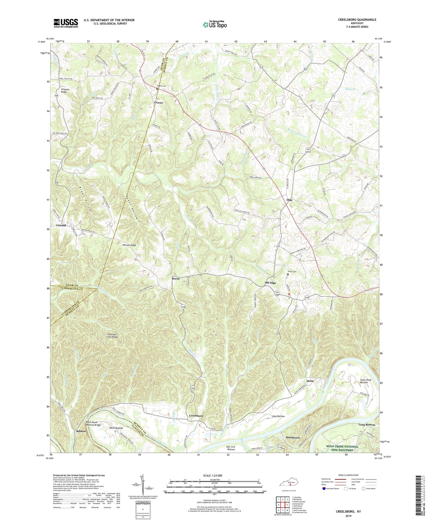
2022 topographic map quadrangle Creelsboro in the state of Kentucky. Scale: 1:24000. Based on the newly updated USGS 7.5' US Topo map series, this map is in the following counties: Russell, Adair, Clinton, Cumberland. The map contains contour data, water features, and other items you are used to seeing on USGS maps, but also has updated roads and other features. This is the next generation of topographic maps. Printed on high-quality waterproof paper with UV fade-resistant inks.
Quads adjacent to this one:
West: Amandaville
Northwest: Columbia
North: Montpelier
Northeast: Russell Springs
East: Jamestown
Southeast: Cumberland City
South: Wolf Creek Dam
Southwest: Burkesville
This map covers the same area as the classic USGS quad with code o36085h2.
Contains the following named places: Battle Branch, Beech Grove School, Blackfish Creek, Blankenship School, Bledsoe Creek, Bradley School, Brown Hollow, Bryan, Bryan Division, Buttler Creek, Cedar Grove Church, Cedar Grove School, Cherry Grove School, Chestnut Flat Ridge, Coe Creek, Coffey Grove School, Coffey School, Creelsboro, Crocus, Denmark School, Dixon Cemetery, Dykes Hollow, Fair View Church, Glable Branch, Grider Chapel, Hayes Chapel, Helm, Highway Mission, Jim Creek, Little Indian Creek, Long Bottom, Manntown, Melson Ridge, Melson Ridge School, Mill Creek, Millers Creek, Mount Vernon Church, Mud Lick Creek, Old Olga, Olga, Potts Branch, Ragen Cemetery, Ramsey Creek, Ribbon, Rock House Natural Bridge, Rock Lick Creek, Salt Lick Bottom, Salt Lick Creek, Simpson Ridge, South Russell Volunteer Fire Department, Swan Pond Bottom, Sycamore Creek, Temple Hill Church, Tres Creek, Turner Branch, Union Chapel School, Wells Bottom, ZIP Codes: 42629, 42741