MyTopo
Waterview Kentucky US Topo Map
Couldn't load pickup availability
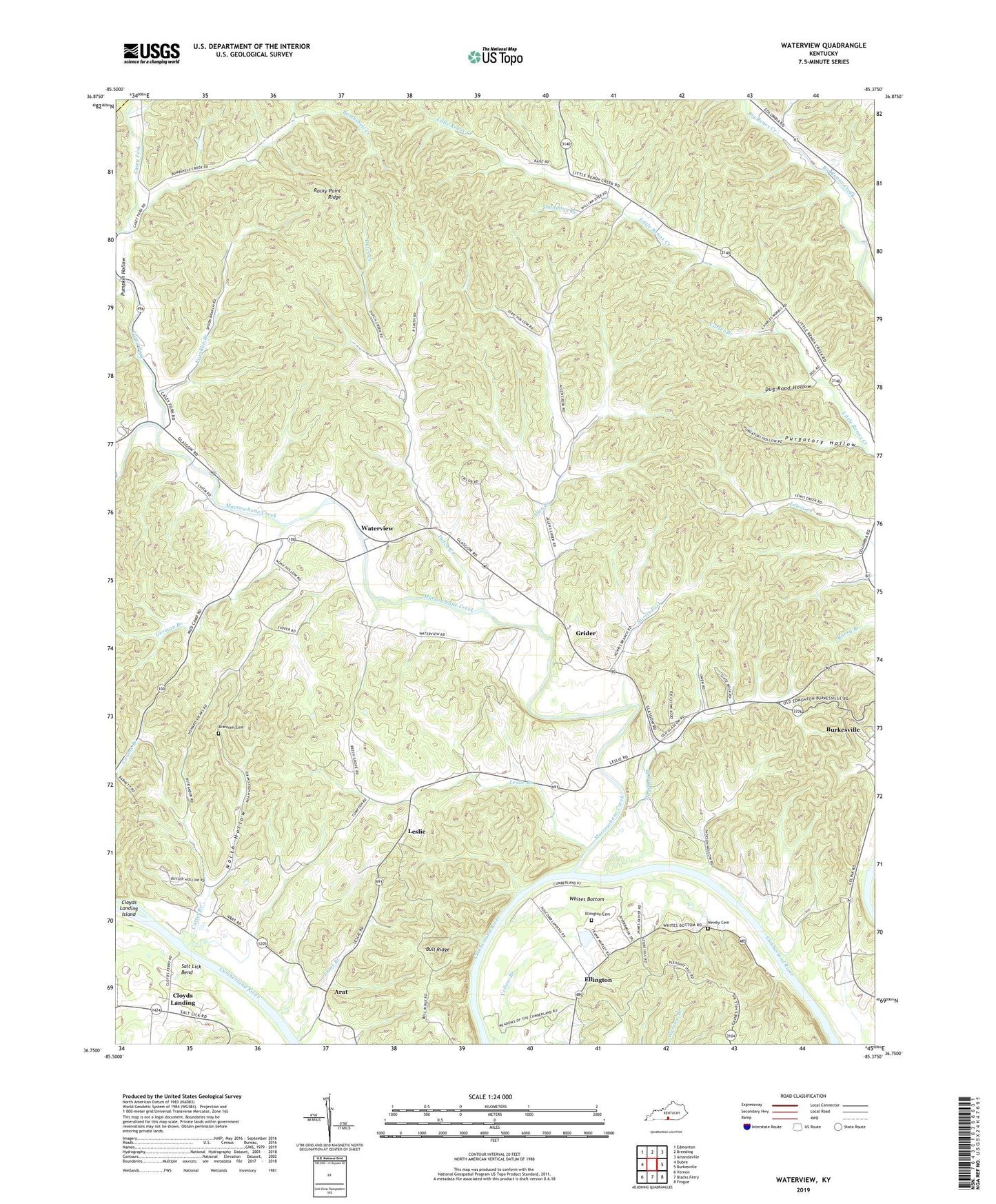
2022 topographic map quadrangle Waterview in the state of Kentucky. Scale: 1:24000. Based on the newly updated USGS 7.5' US Topo map series, this map is in the following counties: Cumberland, Metcalfe. The map contains contour data, water features, and other items you are used to seeing on USGS maps, but also has updated roads and other features. This is the next generation of topographic maps. Printed on high-quality waterproof paper with UV fade-resistant inks.
Quads adjacent to this one:
West: Dubre
Northwest: Edmonton
North: Breeding
Northeast: Amandaville
East: Burkesville
Southeast: Frogue
South: Blacks Ferry
Southwest: Vernon
This map covers the same area as the classic USGS quad with code o36085g4.
Contains the following named places: Allen Creek, Arat, Baise Chapel, Beech Grove School, Big Renox, Bombshell Creek, Branham Cemetery, Bull Ridge, Burkesville Division, Carter Branch, Casey Fork, Casey Fork School, Cloyds Landing, Cloyds Landing Island, Cumberland County, Cumberland Overlook, Dug Road Hollow, Dutch Creek, Dutch Creek Church, Ellington, Ellington Cemetery, Franklin Branch, German Branch, Grider, Haggard Branch, Leslie, Leslie Branch, Leslie School, Lions Branch, Little Renox, Little Renox School, Marrowbone Creek, Mount Hope Church, Newby Cemetery, Norris Fork, North Hollow, Oliver Ferry, Pleasant Hill School, Pumpkin Hollow, Purgatory Hollow, Rocky Point Ridge, Shaddoan Branch, Strange Branch, Sugar Grove, Sugar Grove School, Waterview, Whites Bottom, WKYR-FM (Burkesville), Yellow Branch, Youngs School, ZIP Code: 42717