MyTopo
Austin Kentucky US Topo Map
Couldn't load pickup availability
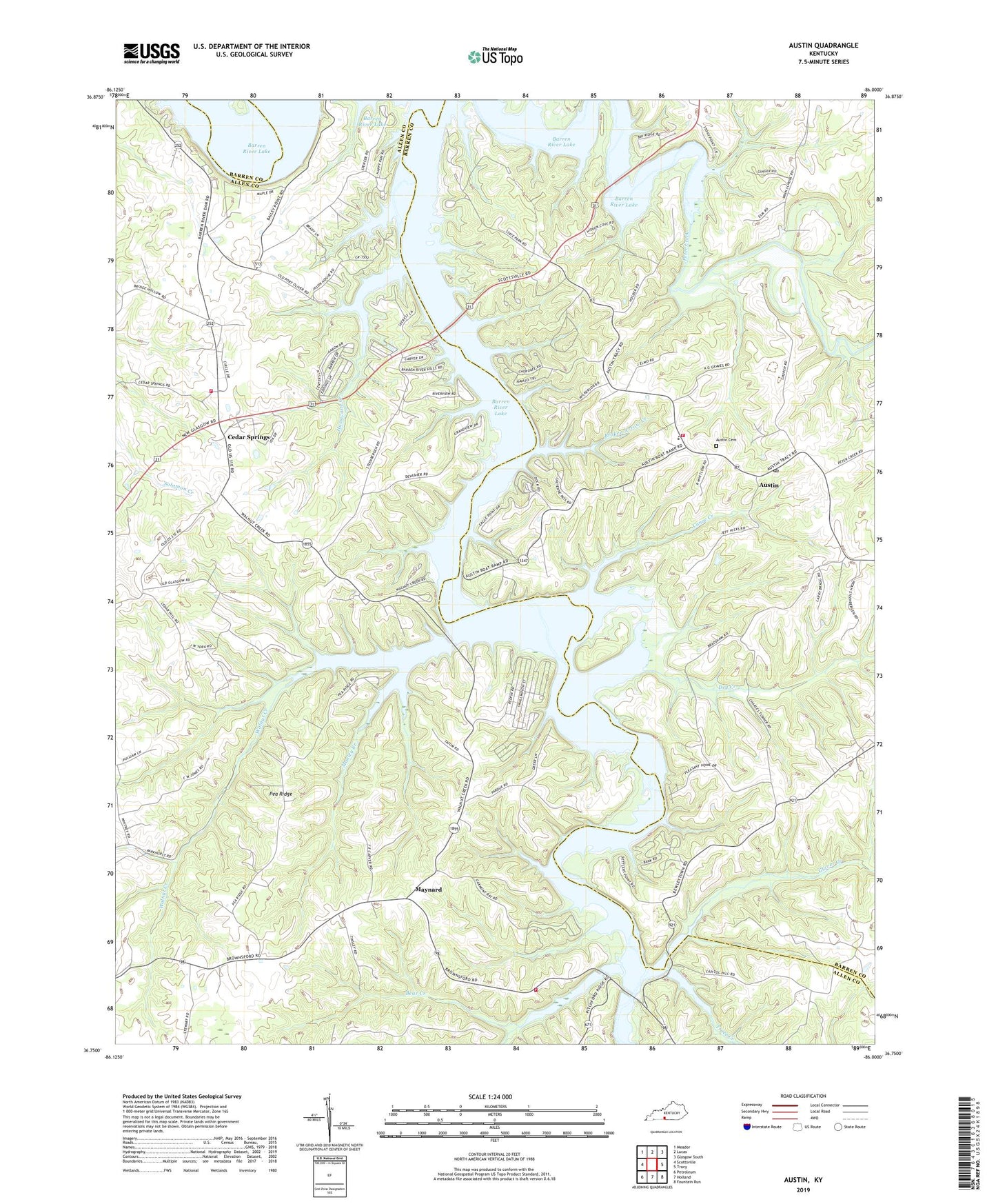
2022 topographic map quadrangle Austin in the state of Kentucky. Scale: 1:24000. Based on the newly updated USGS 7.5' US Topo map series, this map is in the following counties: Barren, Allen. The map contains contour data, water features, and other items you are used to seeing on USGS maps, but also has updated roads and other features. This is the next generation of topographic maps. Printed on high-quality waterproof paper with UV fade-resistant inks.
Quads adjacent to this one:
West: Scottsville
Northwest: Meador
North: Lucas
Northeast: Glasgow South
East: Tracy
Southeast: Fountain Run
South: Holland
Southwest: Petroleum
This map covers the same area as the classic USGS quad with code o36086g1.
Contains the following named places: Austin, Austin Boat Ramp, Austin Cemetery, Austin Post Office, Austin Tracy Fire Department, Austin-Tracy School, Barren River Lake, Barren River Lake State Resort Park, Barren River Lake State Resort Park Golf Course, Bear Creek, Broken Arrow Creek, Browns Ford Boat Ramp, Canoe Creek, Capitol Hill Church, Cedar Cross Church, Cedar Springs, Cedar Springs Fire Department, Cedar Springs Fire Department Substation, Corinth Church, Dry Creek, Durham Springs Church, Glover Creek, Hopewell Church, Hurricane Creek, Manley Branch, Mason Island, Maynard, New Bethel Church, Park Site Boat Ramp, Pea Ridge, Pleasant Home Church, Rhoden Creek, Trace Creek, Walnut Creek, Walnut Creek Boat Ramp, ZIP Code: 42156