MyTopo
Fountain Run Kentucky US Topo Map
Couldn't load pickup availability
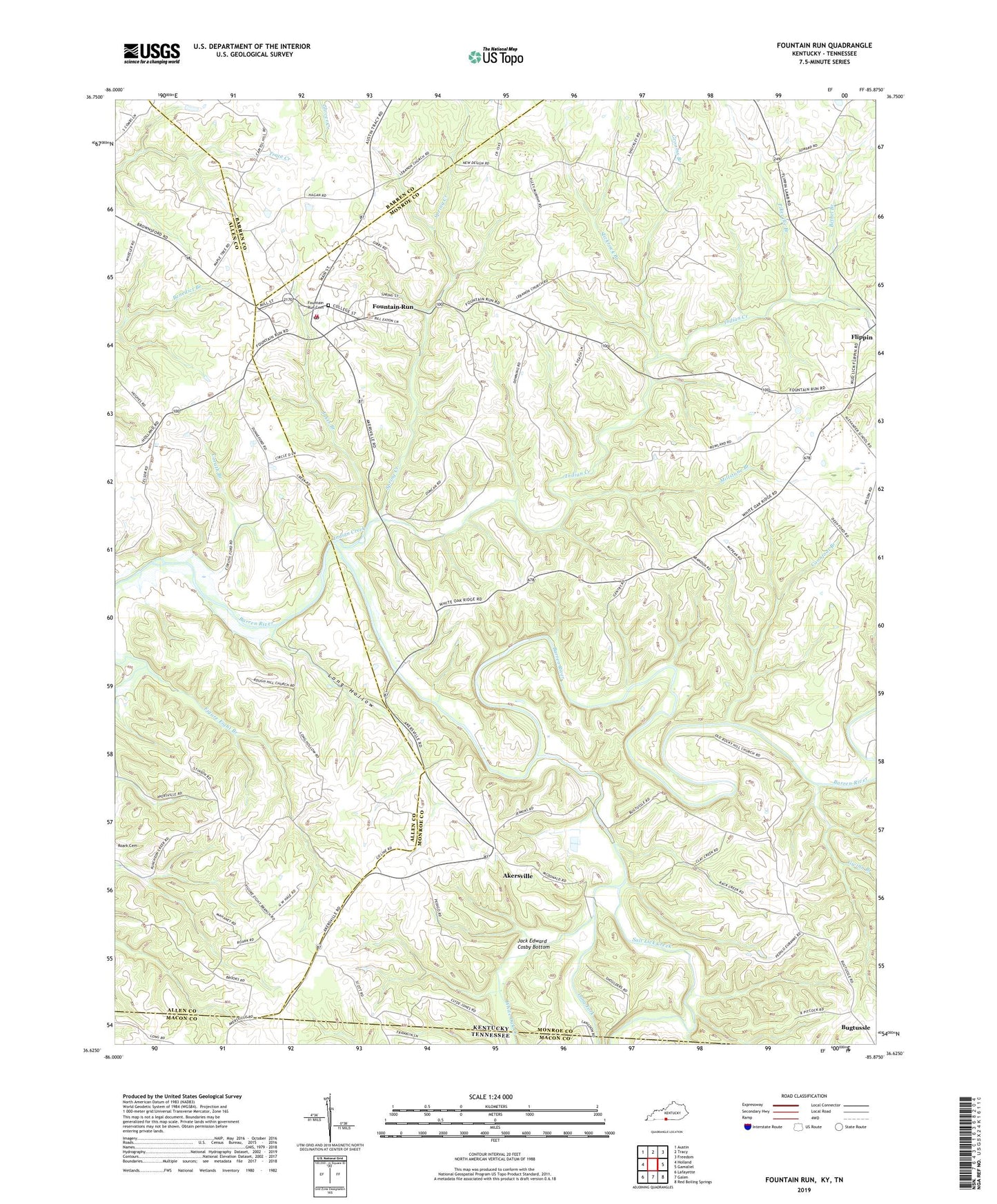
2022 topographic map quadrangle Fountain Run in the states of Kentucky, Tennessee. Scale: 1:24000. Based on the newly updated USGS 7.5' US Topo map series, this map is in the following counties: Monroe, Allen, Barren, Macon. The map contains contour data, water features, and other items you are used to seeing on USGS maps, but also has updated roads and other features. This is the next generation of topographic maps. Printed on high-quality waterproof paper with UV fade-resistant inks.
Quads adjacent to this one:
West: Holland
Northwest: Austin
North: Tracy
Northeast: Freedom
East: Gamaliel
Southeast: Red Boiling Springs
South: Galen
Southwest: Lafayette
Contains the following named places: Akersville, Bethel Branch, Bugtussle, City of Fountain Run, Coonfoot Branch, Coruth Branch, Flatwoods School, Fountain Run, Fountain Run Cemetery, Fountain Run Mennonite Church, Fountain Run Post Office, Fountain Run School, Fountain Run Volunteer Fire Department, Grooms Branch, Gwinn Branch, Howard School, Indian Creek, Jack Edward Cosby Bottom, Jakes Branch, John Wilson Run, Lebanon Church, Long Fork, Long Hollow, Maple Grove Church, Midway School, Millstone Branch, New Design Church, New Liberty Church, Old Rocky Hill Church, Old Rocky Hill School, Old Walnut Grove School, Pikesville, Pikesville Branch, Pikesville Cemetery, Pikesville School No. 1, Pikesville School No. 2, Puncheon Creek, Rough Hill Church, Salt Lick Creek, Slickrock Branch, Spring Creek, White Creek, White Oak Creek, White Oak Ridge Church, Wood Church, ZIP Code: 42133