MyTopo
Berea Kentucky US Topo Map
Couldn't load pickup availability
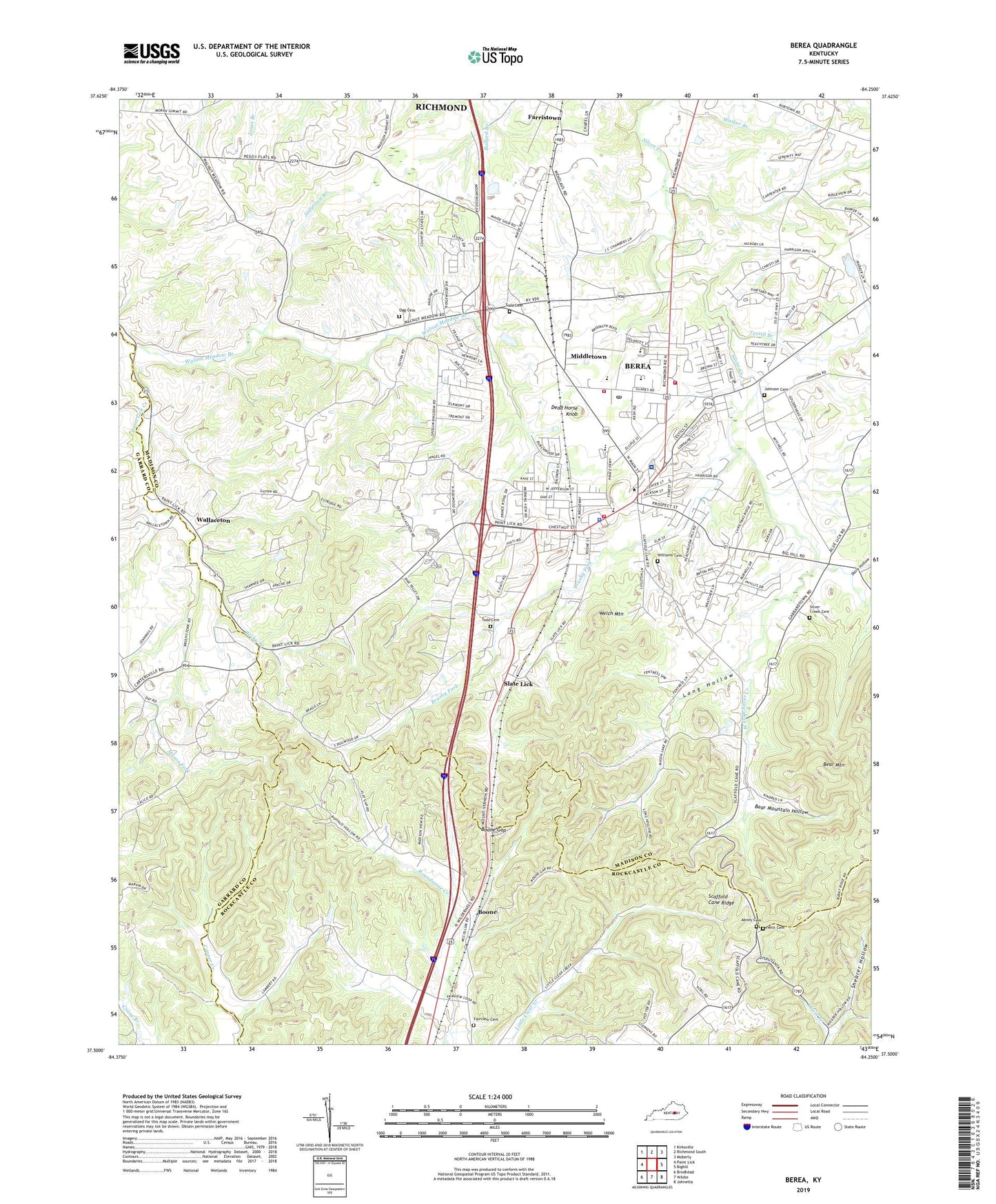
2022 topographic map quadrangle Berea in the state of Kentucky. Scale: 1:24000. Based on the newly updated USGS 7.5' US Topo map series, this map is in the following counties: Madison, Rockcastle, Garrard. The map contains contour data, water features, and other items you are used to seeing on USGS maps, but also has updated roads and other features. This is the next generation of topographic maps. Printed on high-quality waterproof paper with UV fade-resistant inks.
Quads adjacent to this one:
West: Paint Lick
Northwest: Kirksville
North: Richmond South
Northeast: Moberly
East: Bighill
Southeast: Johnetta
South: Wildie
Southwest: Brodhead
This map covers the same area as the classic USGS quad with code o37084e3.
Contains the following named places: Abney Cemetery, Allen Chapel, Asbury Post Office, Baker School, Bear Mountain, Bear Mountain Hollow, Berea, Berea City Police Department, Berea College, Berea Fire Department Station No 1, Berea Fire Department Station Number 2, Berea Post Office, Berea Volunteer Fire and Rescue, Bethal Baptist Church, Blythewood Estates, Boone, Boone Gap, Brushy Fork, City of Berea, Davis Hollow, Dead Horse Knob, East Fork Silver Creek, Fairview Cemetery, Farristown, Flat Gap Baptist Church, Foley Middle School, Galilee Church, Gap Station, Glades Christian Church, Gospel Tabernacle, Johnson Cemetery, Johnsons Shop Post Office, Judytown Branch, KentuckyOne Health Saint Joseph Berea Hospital, Long Hollow, Macedonia Church, Mason Fork, Mason Fork Baptist Church, Mayde Railroad Station, Middletown, Middletown Baptist Church, Ogg Cemetery, Rocky Branch, Scaffold Cane Ridge, Shearer Hollow, Silver Creek Baptist Church, Silver Creek Cemetery, Silver Creek School, Slate Lick, Slate Lick Railroad Station, Snider Station, Terrill Branch, The Glades, Todd Cemetery, Union Church of Christ Historical Marker, Upper Silver Creek School, Wallaceton, Wallaceton Baptist Church, Wallaceton Post Office, Walleceton United methodist Church, Walnut Meadow Branch, Welch Mountain, West Fork Silver Creek, West Side Church, Williams Cemetery, Witt Cemetery, WKXO-AM (Berea), Wolf Branch, ZIP Codes: 40403, 40404