MyTopo
Moberly Kentucky US Topo Map
Couldn't load pickup availability
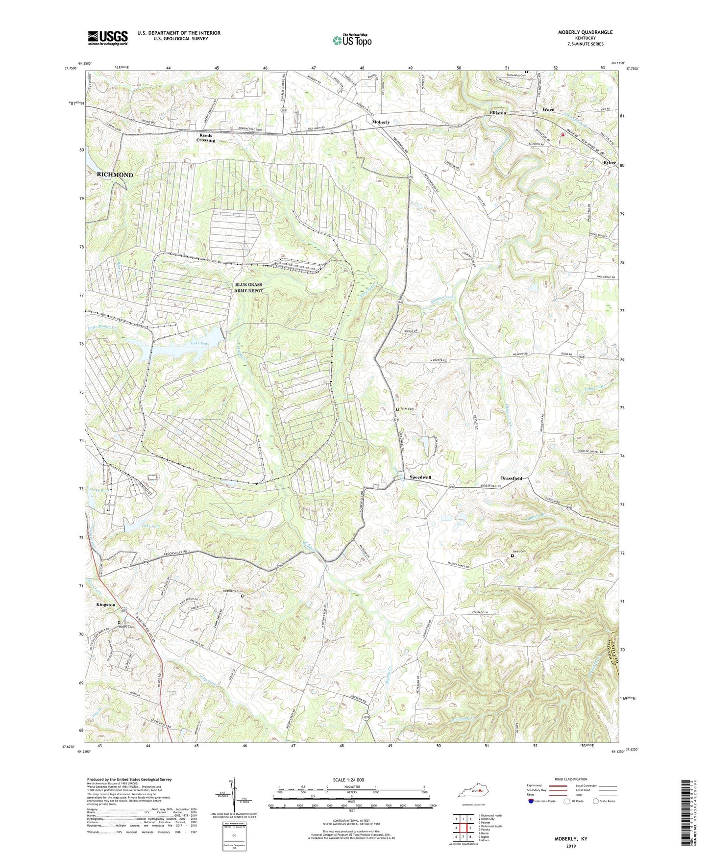
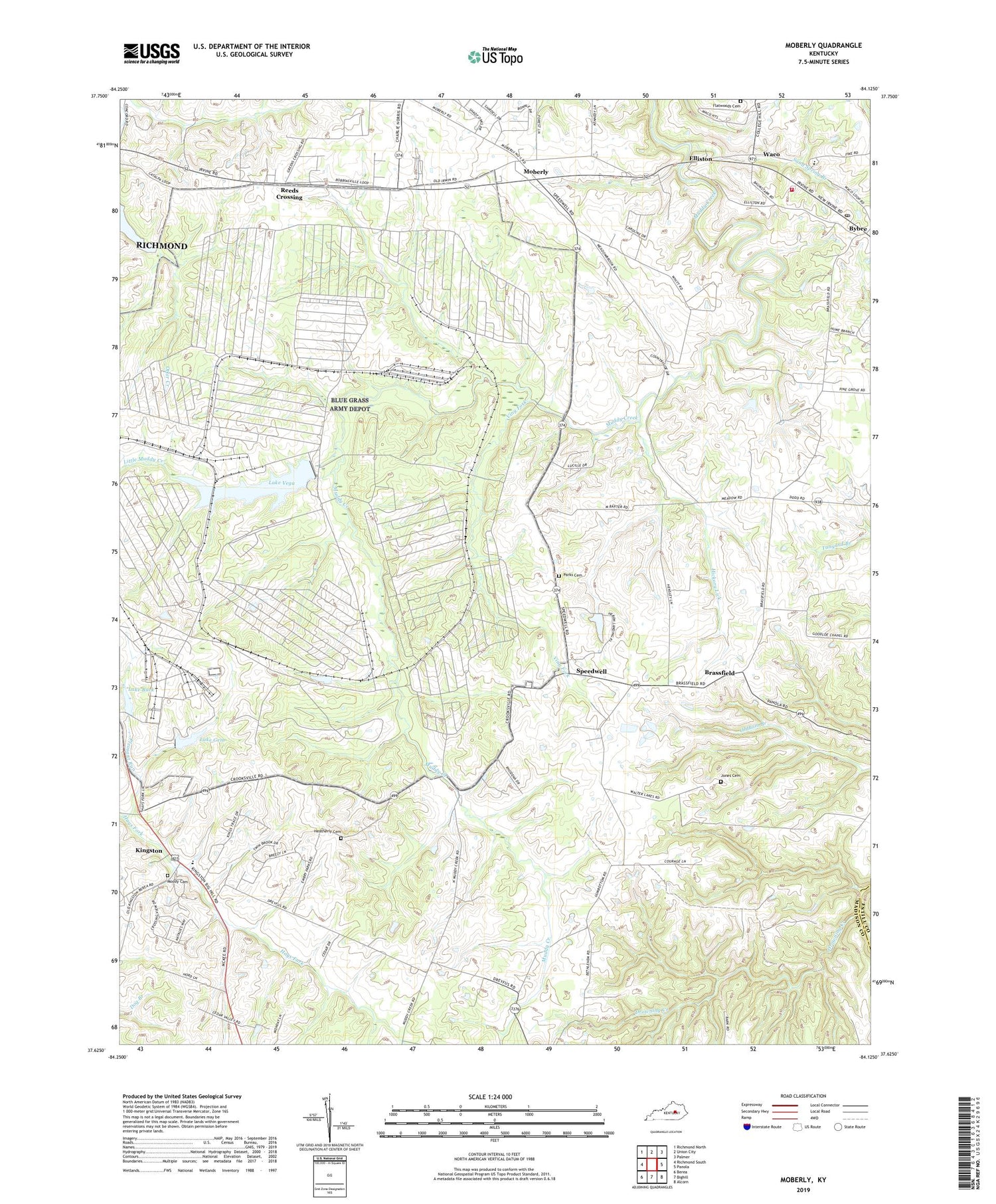
2022 topographic map quadrangle Moberly in the state of Kentucky. Scale: 1:24000. Based on the newly updated USGS 7.5' US Topo map series, this map is in the following counties: Madison, Estill. The map contains contour data, water features, and other items you are used to seeing on USGS maps, but also has updated roads and other features. This is the next generation of topographic maps. Printed on high-quality waterproof paper with UV fade-resistant inks.
Quads adjacent to this one:
West: Richmond South
Northwest: Richmond North
North: Union City
Northeast: Palmer
East: Panola
Southeast: Alcorn
South: Bighill
Southwest: Berea
This map covers the same area as the classic USGS quad with code o37084f2.
Contains the following named places: Blue Grass Army Depot, Brassfield, Brassfield Post Office, Brassfield Railroad Station, Brassfield School, Bybee Post Office, Central Kentucky Wildlife Management Area, Colyer Post Office, Concord School, Crooksville, Eastern Kentucky University Meadow Brook Farm, Elliston, Elliston Post Office, Evergreen Farm, Flatwoods Cemetery, Fredrick Post Office, Goodloe Chapel, Hays Fork Church, Heatherly Cemetery, Hickory Lick, Jones Cemetery, Kingston, Kingston Post Office, Lake Buck, Lake Gem, Lake Vega, Little Muddy Creek, Moberly, Moberly Post Office, Moberly Railroad Station, Moody Cemetery, Ogg and Covington Mill, Parks Cemetery, Pine Grove Church, Pleasant Run, Poplar Branch, Reeds Crossing, Sand Spring Branch, Shiflet Post Office, SOF Maintenance Site Heliport, Speedwell, Speedwell Post Office, Speedwell School, Viny Fork, Waco, Waco Baptist Church, Waco Elementary School, Waco Post Office, Waco Volunteer Fire Department, Waco-Bybee Division, ZIP Code: 40385