MyTopo
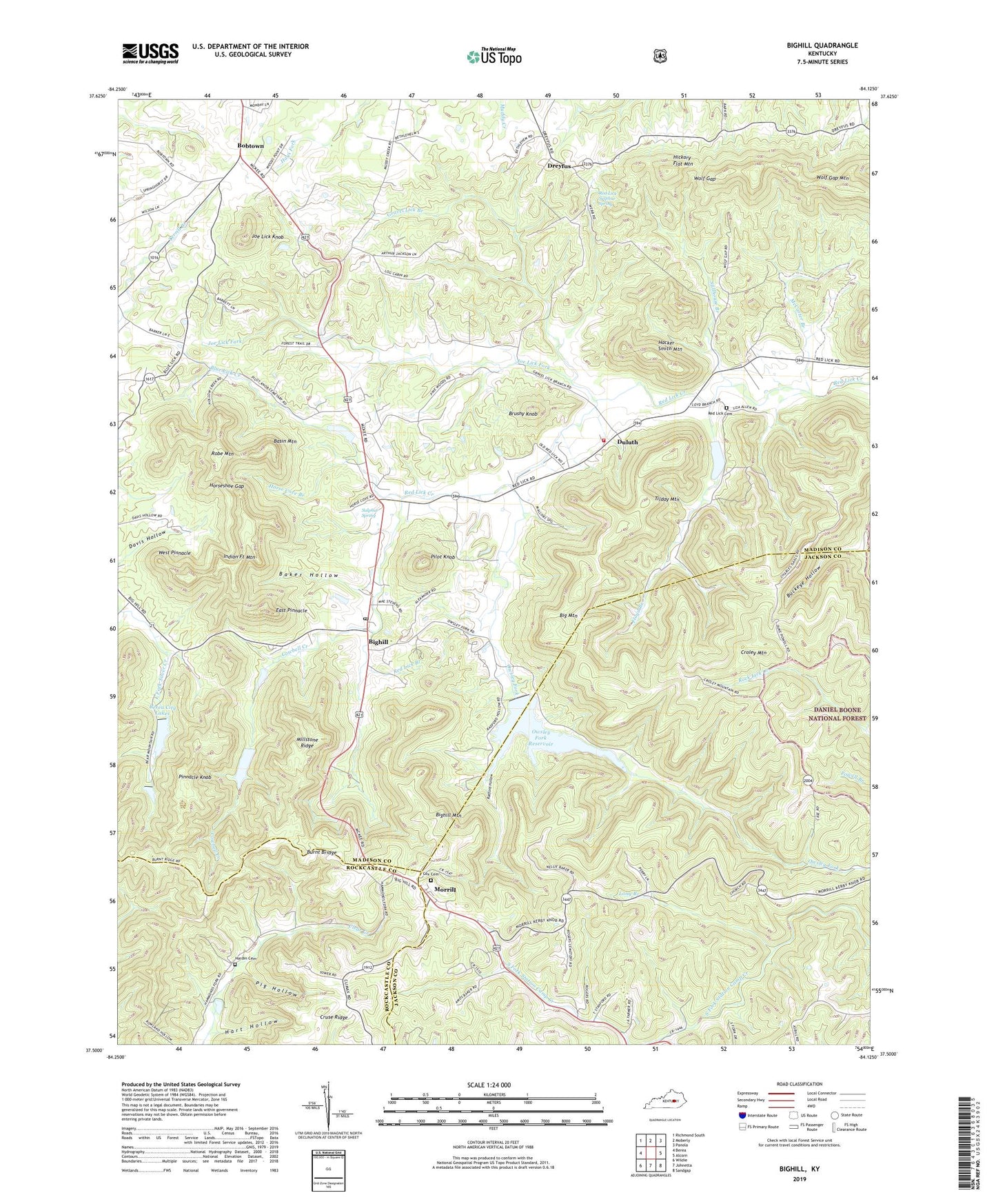
Bighill Kentucky US Topo Map
Couldn't load pickup availability
Also explore the Bighill Forest Service Topo of this same quad for updated USFS data
2022 topographic map quadrangle Bighill in the state of Kentucky. Scale: 1:24000. Based on the newly updated USGS 7.5' US Topo map series, this map is in the following counties: Madison, Jackson, Rockcastle. The map contains contour data, water features, and other items you are used to seeing on USGS maps, but also has updated roads and other features. This is the next generation of topographic maps. Printed on high-quality waterproof paper with UV fade-resistant inks.
Quads adjacent to this one:
West: Berea
Northwest: Richmond South
North: Moberly
Northeast: Panola
East: Alcorn
Southeast: Sandgap
South: Johnetta
Southwest: Wildie
This map covers the same area as the classic USGS quad with code o37084e2.
Contains the following named places: Baker, Baker Hollow, Baker School, Bark Road Church, Bark Road School, Basin Mountain, Berea City Lakes, Berea College Forest, Berea Division, Big Hill, Big Hill School, Big Mountain, Bighill, Bighill Mountain, Bighill Post Office, Bighill School, Blue Lick Creek, Bobtown, Bobtown School, Brushy Knob, Buckeye Hollow, Burnt Bridge, Cowbell Creek, Cox Cemetery, Coyle Post Office, Croley Mountain, Cruse Ridge, Cruse Ridge School, Dreyfus, Dreyfus Post Office, Duluth, Duluth Post Office, East Pinnacle, Floyd Branch, Gravel Lick Branch, Hacker Smith Mountain, Hardin Cemetery, Hart Hollow, Hickory Flat Mountain, Horse Cove Branch, Horseshoe Gap, Hugh, Hugh Church, Hugh Post Office, Hugh School, Indian Fort Mountain, Indian Fort Theatre, Joe Lick Fork, Joe Lick Knob, Log Cabin School, Long Branch, Malory Mineral Spring, Maplewood Farm, McCarter Branch, Millstone Ridge, Morrill, Morrill Post Office, New Liberty Baptist Church, Owsley Fork, Owsley Fork Reservoir, Pig Hollow, Pilot Knob, Pilot Knob Baptist Church, Pinnacle Knob, Radford Hollow, Red Lick Baptist Church, Red Lick Branch, Red Lick Cemetery, Red Lick Sulphur Spring, Red Lick Volunteer Fire Department, Robe Mountain, Shirley Post Office, Stillhouse Branch, Sulphur Spring, Tilday Mountain, Walnut Valley Post Office, West Pinnacle, WKXO-FM (Berea), Wolf Gap, Wolf Gap Mountain