MyTopo
Campbellsburg Kentucky US Topo Map
Couldn't load pickup availability
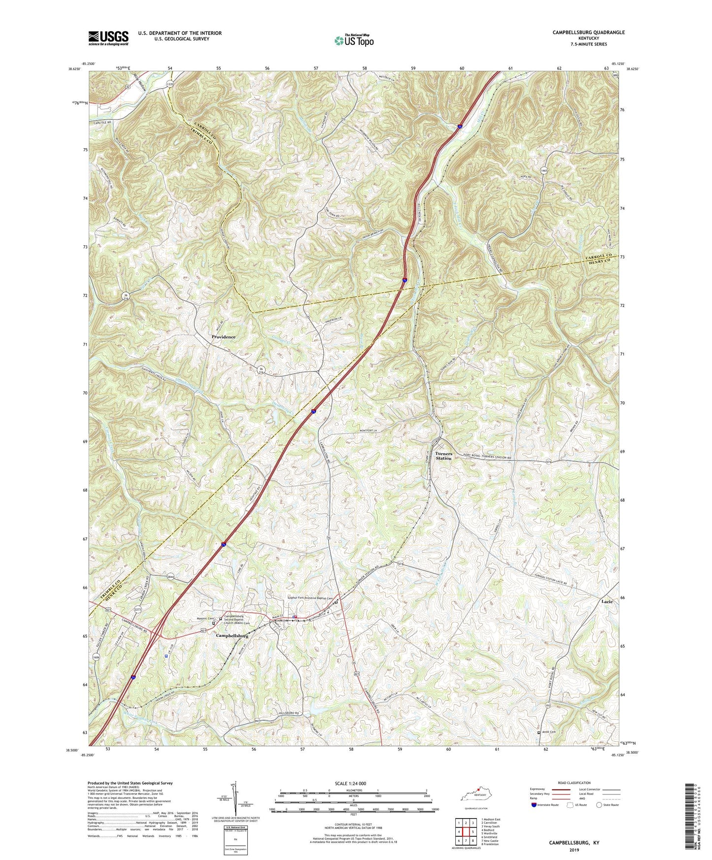
2022 topographic map quadrangle Campbellsburg in the state of Kentucky. Scale: 1:24000. Based on the newly updated USGS 7.5' US Topo map series, this map is in the following counties: Henry, Carroll, Trimble. The map contains contour data, water features, and other items you are used to seeing on USGS maps, but also has updated roads and other features. This is the next generation of topographic maps. Printed on high-quality waterproof paper with UV fade-resistant inks.
Quads adjacent to this one:
West: Bedford
Northwest: Madison East
North: Carrollton
Northeast: Vevay South
East: Worthville
Southeast: Franklinton
South: New Castle
Southwest: Smithfield
This map covers the same area as the classic USGS quad with code o38085e2.
Contains the following named places: Adcock Post Office, Antill Cemetery, Barnes Railroad Siding, Brents Post Office, Buck Creek, Campbellsburg, Campbellsburg Division, Campbellsburg Fire Department, Campbellsburg Police Department, Campbellsburg Post Office, Campbellsburg Railroad Station, Campbellsburg Second Baptist Church Cemetery, Carrs Creek, City of Campbellsburg, Coleman Spring, East Fork Mill Creek, Gilgal, Gilgal Branch, Hopewell Baptist Church, Jackson Spring, Kentucky State Police Post 5, Lacie, Lacie Post Office, Little Cane Run Baptist Church, Long Branch, Lost Fork, Masonic Cemetery, Mill Creek, Mill Creek Christian Church, Nilly Hollow, Providence, Pryor Branch, Sandefers Store Post Office, School Number Fourteen, School Number Seventeen, School Number Sixteen, School Number Thirty-Nine, School Number Twelve, Sugar Camp Spring, Sulphur Church, Sulphur Fork Primitive Baptist Cemetery, Tomtown, Turkey Run, Turners Railroad Station, Turners Station, Turners Station Post Office, West Fork Mill Creek, ZIP Code: 40011