MyTopo
Madison East Indiana US Topo Map
Couldn't load pickup availability
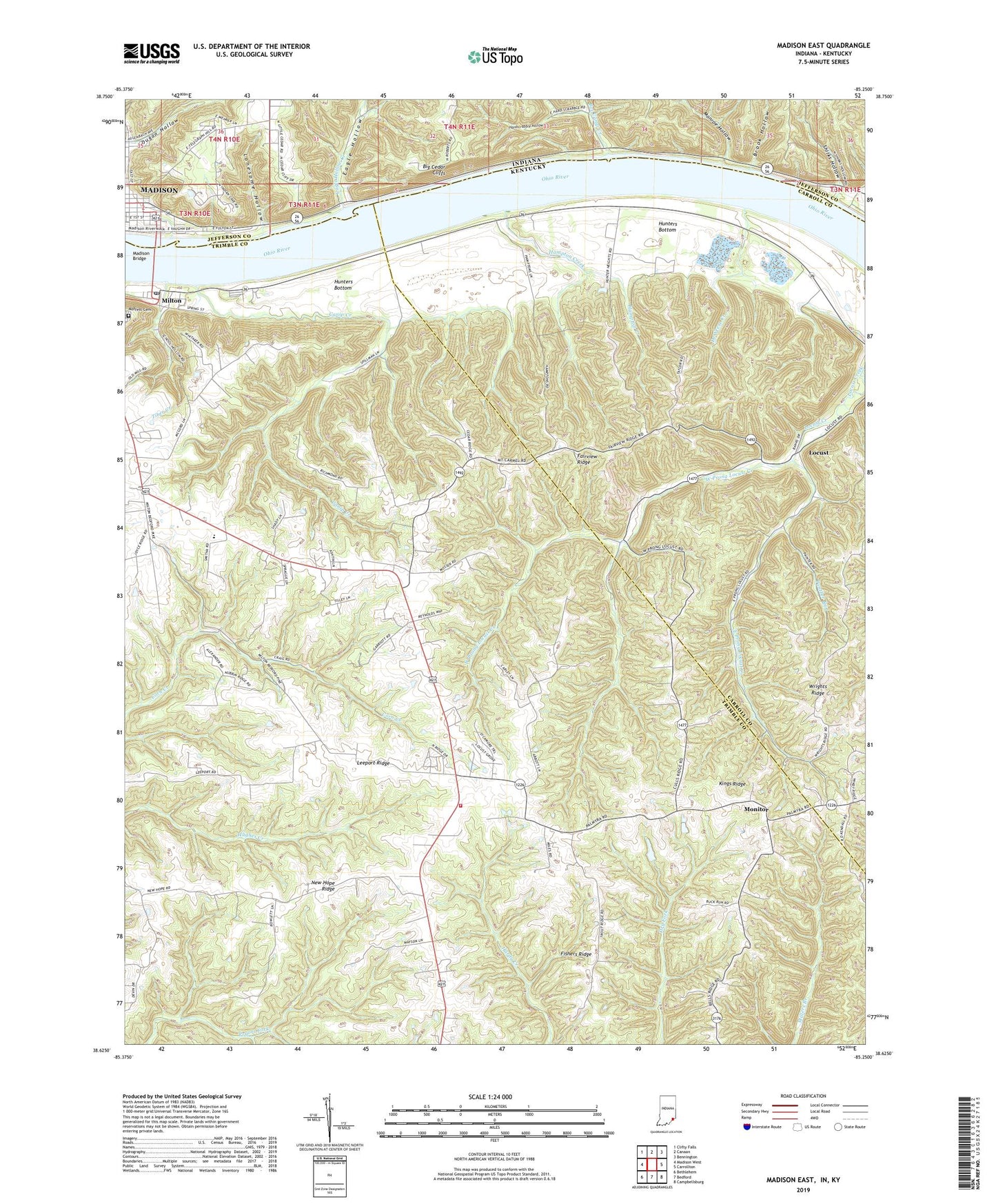
2022 topographic map quadrangle Madison East in the states of Kentucky, Indiana. Scale: 1:24000. Based on the newly updated USGS 7.5' US Topo map series, this map is in the following counties: Jefferson, Trimble, Carroll. The map contains contour data, water features, and other items you are used to seeing on USGS maps, but also has updated roads and other features. This is the next generation of topographic maps. Printed on high-quality waterproof paper with UV fade-resistant inks.
Quads adjacent to this one:
West: Madison West
Northwest: Clifty Falls
North: Canaan
Northeast: Bennington
East: Carrollton
Southeast: Campbellsburg
South: Bedford
Southwest: Bethlehem
Contains the following named places: Bee Camp Creek, Big Cedar Cliffs, Brook Hollow, Callis Grove, Callis Grove Campground, Canip Creek, Cedar Cliffs Park, DeWeese Creek, Dugan Hollow, Eagle Hollow, Eagle Hollow Creek, East Prong Locust Creek, Fairview, Fairview Ridge, Fishers Ridge, Hampton Creek, Hardscrabble Hollow, Hopewell Church, Hopewell Methodist Episcopal Church South, Hunters Bottom, Leeport Ridge, Locust, Locust Baptist Church, Locust Post Office, Locust School, Lonesome Hollow, Madison Bridge, Milton, Milton Post Office, Milton Volunteer Fire and Rescue Department Station 2, Moffett Cemetery, Monitor, Monroe Hollow, Mount Carmel Church, Mount Herman Church, Mount Tabor, New Hope Ridge, North Mount Tabor, Panther Run, Pilgrim Holiness Church, Saint Johns United Church of Christ, Saint Peters Church, School Number Nineteen, School Number Thirty-Three, Shirks Hollow, South Mount Tabor, Tiber Creek, Trimble County Emergency Medical Services, Union Grove Church, WCJC-FM (Madison), West Prong Locust Creek, WORX-AM (Madison), Wrights Ridge, ZIP Code: 40045