MyTopo
New Castle Kentucky US Topo Map
Couldn't load pickup availability
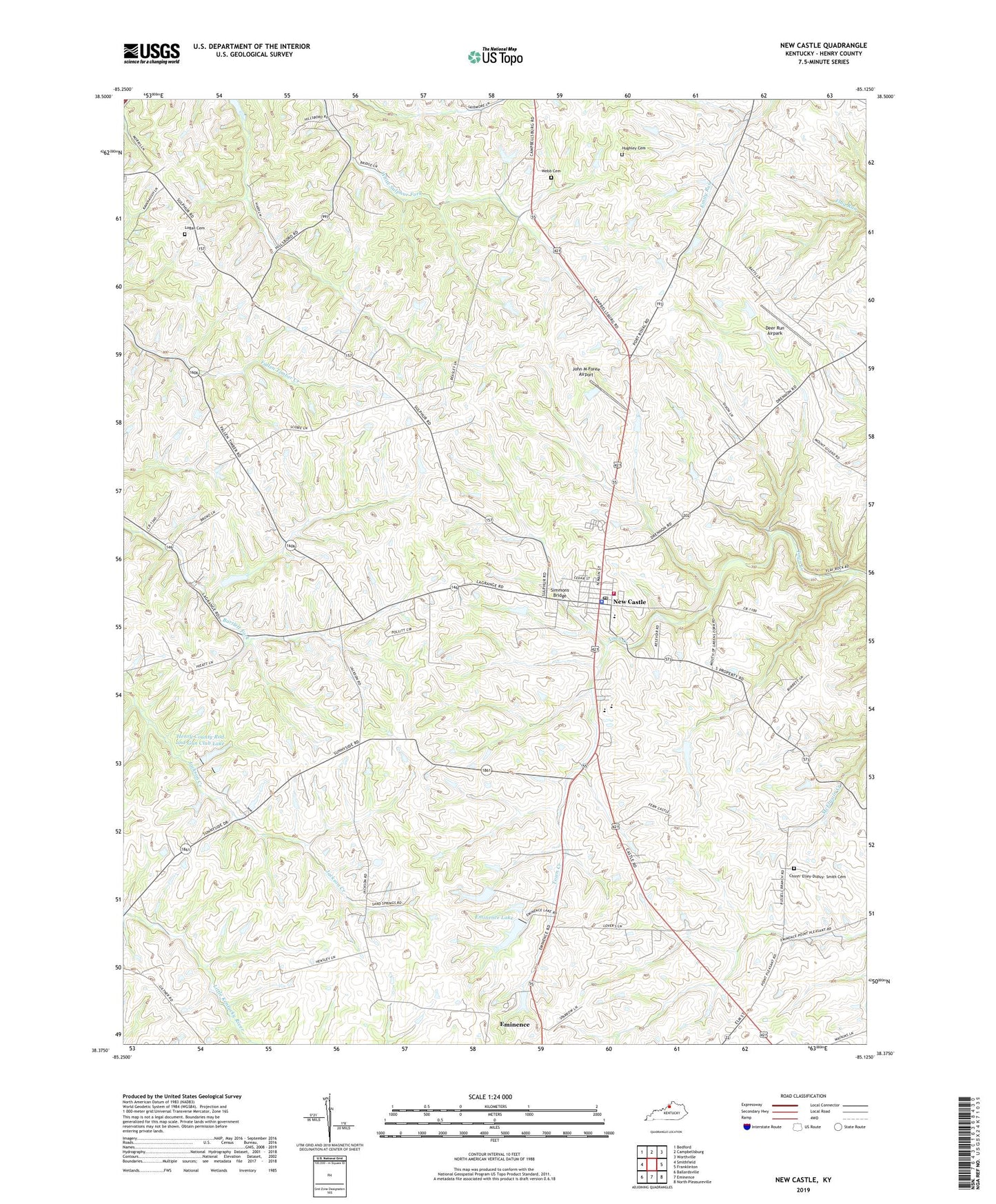
2022 topographic map quadrangle New Castle in the state of Kentucky. Scale: 1:24000. Based on the newly updated USGS 7.5' US Topo map series, this map is in the following counties: Henry. The map contains contour data, water features, and other items you are used to seeing on USGS maps, but also has updated roads and other features. This is the next generation of topographic maps. Printed on high-quality waterproof paper with UV fade-resistant inks.
Quads adjacent to this one:
West: Smithfield
Northwest: Bedford
North: Campbellsburg
Northeast: Worthville
East: Franklinton
Southeast: North Pleasureville
South: Eminence
Southwest: Ballardsville
This map covers the same area as the classic USGS quad with code o38085d2.
Contains the following named places: Bruce Family Cemetery, Chinn - Elley - Dupuy - Smith Cemetery, City of New Castle, Deer Run Airpark, Eminence Lake, Henry County Church, Henry County Emergency Medical Services, Henry County Poor House, Henry County Rod and Gun Club Lake, Henry County Sheriff's Office, Hillsboro Baptist Church, Hillsboro School, Hughley Cemetery, John M Foree Airport, Logan Cemetery, Mount Gilead Church, Mount Gilead School, New Castle, New Castle Division, New Castle Fire Department, New Castle Police Department, New Castle Post Office, Russell School, Sanford School, Simmons Bridge, Webb Cemetery, White Sulphur School, ZIP Codes: 40019, 40050, 40058, 40070