MyTopo
Caneyville Kentucky US Topo Map
Couldn't load pickup availability
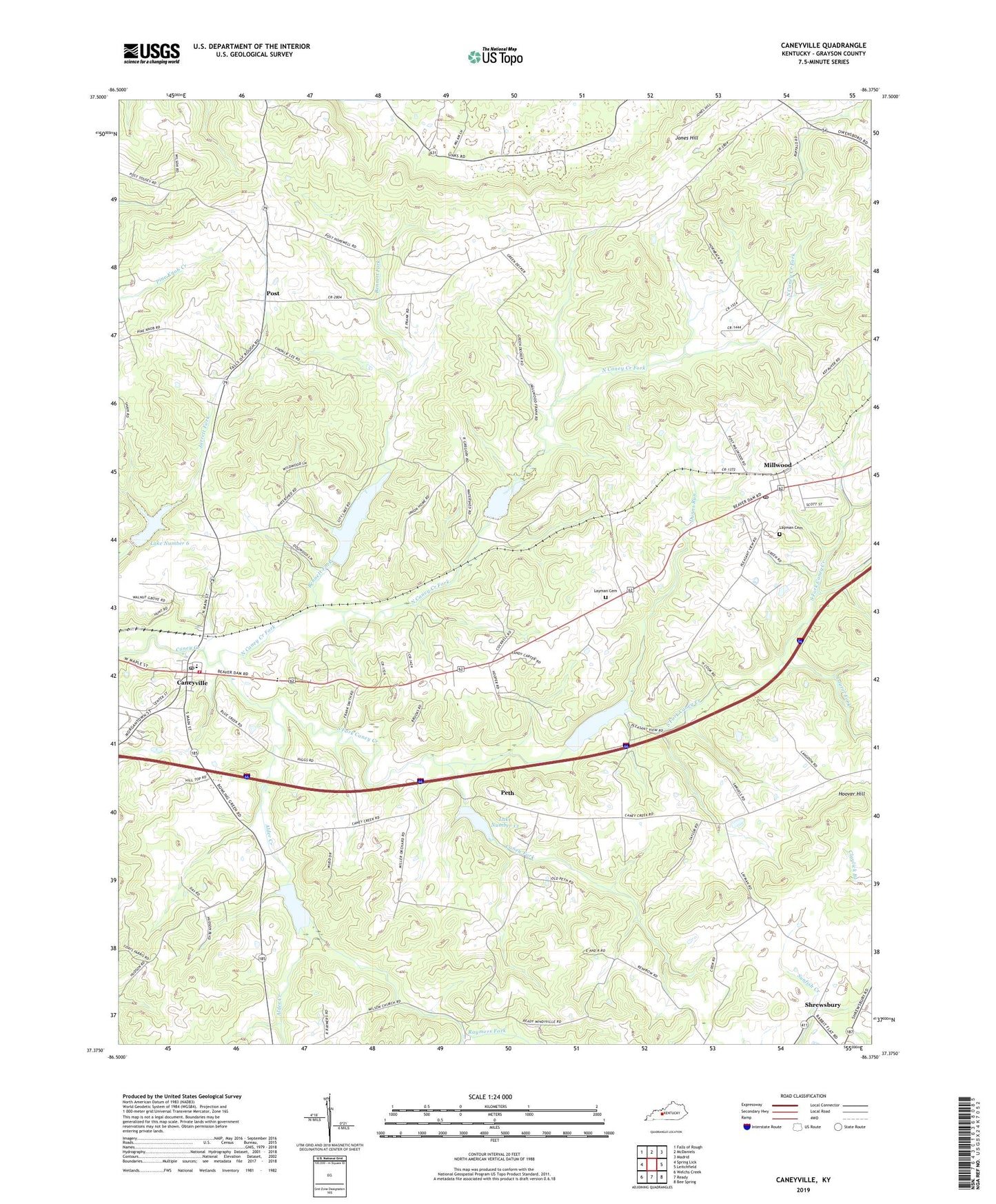
2022 topographic map quadrangle Caneyville in the state of Kentucky. Scale: 1:24000. Based on the newly updated USGS 7.5' US Topo map series, this map is in the following counties: Grayson. The map contains contour data, water features, and other items you are used to seeing on USGS maps, but also has updated roads and other features. This is the next generation of topographic maps. Printed on high-quality waterproof paper with UV fade-resistant inks.
Quads adjacent to this one:
West: Spring Lick
Northwest: Falls of Rough
North: McDaniels
Northeast: Madrid
East: Leitchfield
Southeast: Bee Spring
South: Ready
Southwest: Welchs Creek
This map covers the same area as the classic USGS quad with code o37086d4.
Contains the following named places: Alder Creek, Bennett Fork, Caney Creek Church, Caney Fork, Caneyville, Caneyville Division, Caneyville Post Office, Caneyville Reservoir, Caneyville Volunteer Fire Department, City of Caneyville, Dunns Run, First Apostolic Church, Hoover Hill, Hopewell Church, Jones Hill, Lake Number 1, Lake Number 13, Lake Number 6, Laurel Fork, Layman Memorial Gardens, Macedonia Church, Millwood, Millwood Post Office, New Hope Church, North Caney Creek Fork, Peth, Pine Knob Primitive Baptist Church, Pleasant Valley Church, Pleasant View Church, Post, Raymers Fork, Shrewsbury, South Fork Caney Creek, Union Home Church, Vol Layman Cemetery, Wilson Church, ZIP Codes: 42721, 42762