MyTopo
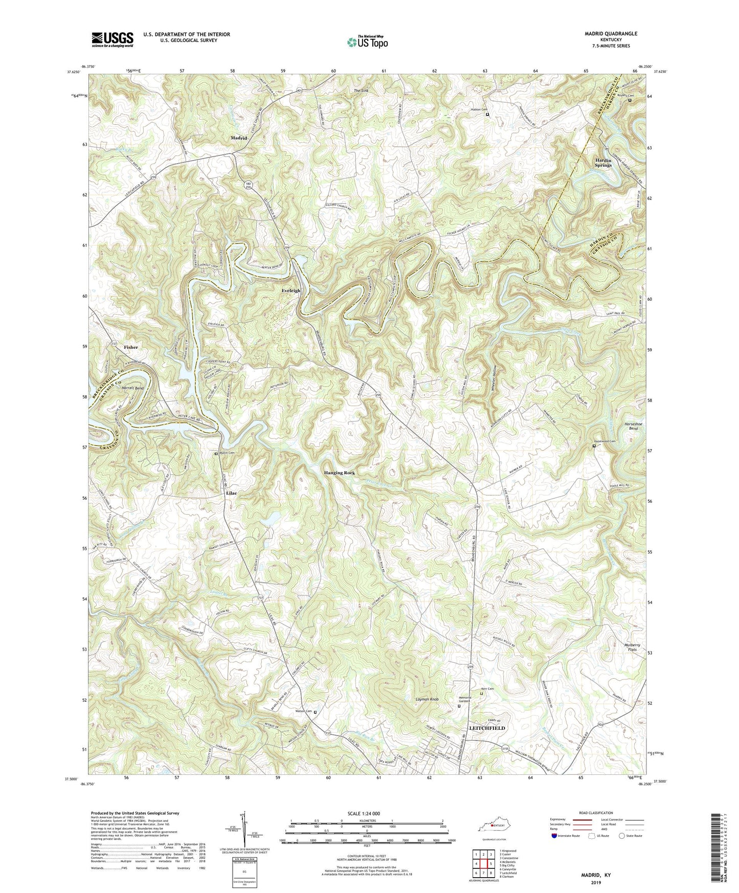
Madrid Kentucky US Topo Map
Couldn't load pickup availability
2022 topographic map quadrangle Madrid in the state of Kentucky. Scale: 1:24000. Based on the newly updated USGS 7.5' US Topo map series, this map is in the following counties: Grayson, Breckinridge, Hardin. The map contains contour data, water features, and other items you are used to seeing on USGS maps, but also has updated roads and other features. This is the next generation of topographic maps. Printed on high-quality waterproof paper with UV fade-resistant inks.
Quads adjacent to this one:
West: McDaniels
Northwest: Kingswood
North: Custer
Northeast: Constantine
East: Big Clifty
Southeast: Clarkson
South: Leitchfield
Southwest: Caneyville
This map covers the same area as the classic USGS quad with code o37086e3.
Contains the following named places: Antioch United Methodist Church, Big Run Branch, Cave School, Clifty Creek, Conklin School, Coyle Cumberland Presbyterian Church, Culbertson Branch, Eveleigh, Eveleigh Church, Fisher, Hanging Rock, Hanging Rock Church, Hardin Springs, Harrell Bend, Hazelwood Cemetery, Holy Church, Horseshoe Bend, Johnson School Branch, Kerr Cemetery, Laurel Branch, Layman Knob, Leitchfield Memorial Gardens, Lilac, Little Clifty Church, Madrid, Meeting Creek, Mount Gillard School, Mount Hebron Church, Mount Vernon Church, Mulberry Flats, Mulberry Flats Church, Mullin Cemetery, Old Hudson Cemetery, Peter Cave Creek, Royalty Cemetery, The Sink, Watson Cemetery, WBFI-FM (McDaniels), Wheeler Hollow, WKHG-FM (Leitchfield), WMTL-AM (Leitchfield)