MyTopo
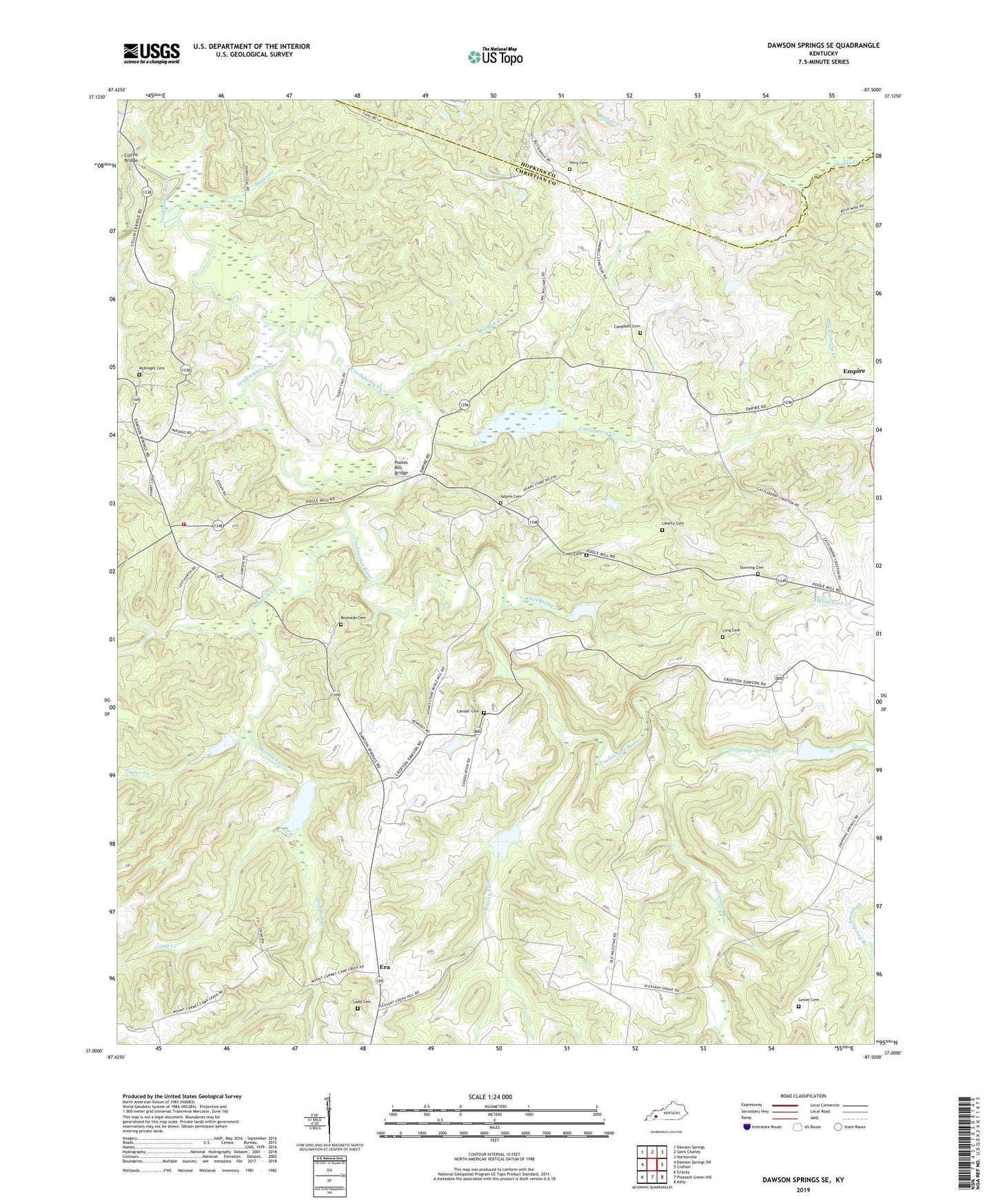
Dawson Springs SE Kentucky US Topo Map
Couldn't load pickup availability
2022 topographic map quadrangle Dawson Springs SE in the state of Kentucky. Scale: 1:24000. Based on the newly updated USGS 7.5' US Topo map series, this map is in the following counties: Christian, Hopkins. The map contains contour data, water features, and other items you are used to seeing on USGS maps, but also has updated roads and other features. This is the next generation of topographic maps. Printed on high-quality waterproof paper with UV fade-resistant inks.
Quads adjacent to this one:
West: Dawson Springs SW
Northwest: Dawson Springs
North: Saint Charles
Northeast: Nortonville
East: Crofton
Southeast: Kelly
South: Pleasant Green Hill
Southwest: Gracey
This map covers the same area as the classic USGS quad with code o37087a5.
Contains the following named places: Adams, Adams Cemetery Number 1, Bethel Church, Brushy Fork, Camp Creek, Campbell Cemetery, Cansler Cemetery, Castleberry, Castleberry Creek, Castleberry General Baptist Church, Collins Bridge, Consolation School, Croft Cemetery, Dripping Spring Branch, Dunning Cemetery, Era, Ladd Cemetery, Lanier Cemetery, Liberty Cemetery, Long Cemetery, McKnight Cemetery, Morgan Creek, Northwest Volunteer Fire Department, Pooles Mill Bridge, Reynolds Cemetery, Sandlick Creek, Sugar Creek, Terry Cemetery, Tugler Creek, Whitehorn Creek