MyTopo
Pleasant Green Hill Kentucky US Topo Map
Couldn't load pickup availability
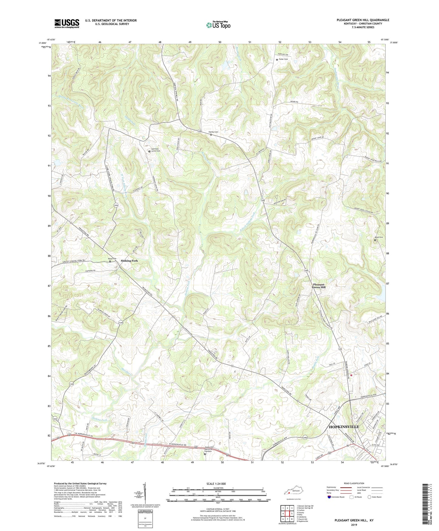
2022 topographic map quadrangle Pleasant Green Hill in the state of Kentucky. Scale: 1:24000. Based on the newly updated USGS 7.5' US Topo map series, this map is in the following counties: Christian. The map contains contour data, water features, and other items you are used to seeing on USGS maps, but also has updated roads and other features. This is the next generation of topographic maps. Printed on high-quality waterproof paper with UV fade-resistant inks.
Quads adjacent to this one:
West: Gracey
Northwest: Dawson Springs SW
North: Dawson Springs SE
Northeast: Crofton
East: Kelly
Southeast: Hopkinsville
South: Church Hill
Southwest: Caledonia
This map covers the same area as the classic USGS quad with code o36087h5.
Contains the following named places: Allen Grove Church, Dick Boyd Cemetery, East Fork Sinking Fork, Edgewood Chapel, Fuller Cemetery, Green Hill Memorial Gardens, Hamby Cemetery, Harmony Grove Cemetery, Lake Blythe, Mount Zion Church, Muddy Fork, New Palestine Baptist Church, Palestine, Pleasant Green Hill, Pleasant Green United Methodist Church, Shiloh United Methodist Church, Shurdan Creek, Sim Chapel, Sinking Fork, Sinking Fork Baptist Church, Sinking Fork Christian Church, West Fork Sinking Fork, West Mount Zoar Church, West Side Volunteer Fire Department, WHOP-AM (Hopkinsville), WHOP-FM (Hopkinsville), Wood Cemetery