MyTopo
Dawson Springs Kentucky US Topo Map
Couldn't load pickup availability
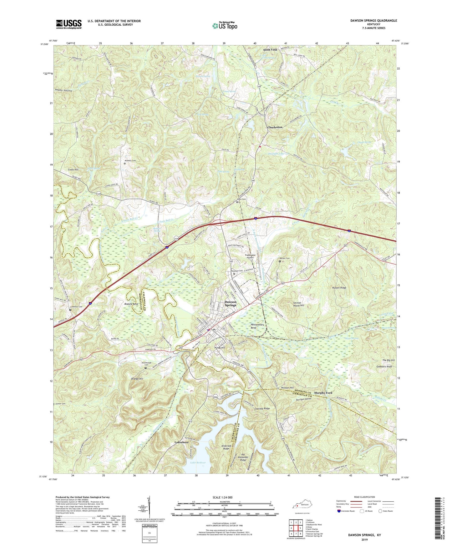
2022 topographic map quadrangle Dawson Springs in the state of Kentucky. Scale: 1:24000. Based on the newly updated USGS 7.5' US Topo map series, this map is in the following counties: Hopkins, Caldwell, Christian. The map contains contour data, water features, and other items you are used to seeing on USGS maps, but also has updated roads and other features. This is the next generation of topographic maps. Printed on high-quality waterproof paper with UV fade-resistant inks.
Quads adjacent to this one:
West: Olney
Northwest: Dalton
North: Coiltown
Northeast: Madisonville West
East: Saint Charles
Southeast: Dawson Springs SE
South: Dawson Springs SW
Southwest: Princeton East
This map covers the same area as the classic USGS quad with code o37087b6.
Contains the following named places: Allsbrook Ridge, Ausenbaugh Cemetery, Beshear Spring, Blakely Bend, Blue Hole Hollow, Buffalo Creek, Bull Creek, Caney Creek, Cap Spring, Chapel Spring, Charleston, Charleston Volunteer Fire Department, City of Dawson Springs, Coatney Ridge, Coats Hill, Creekmur Cemetery, Dawson Springs, Dawson Springs Division, Dawson Springs Police Department, Dawson Springs Post Office, Dawson Springs Volunteer Fire Department, Daylight Lake, Dunn Cemetery, Dunn Church, Durrigan Hollow, East Fork Bull Creek, East Fork Hurricane Creek, Fork Spring, Gibb Spring, Gobblers Knob, Howton Spring, Hurricane Creek, Lakeshore, Lick Church, Lick Creek Spring, Maple Swamp, McNeely Cemetery, Menser Cemetery, Montgomery Creek, Mount Hebron Church, Mount Pisgah Baptist Church, Murphy Ford, Nickson Hill, North Fork Bull Creek, North Fork Hurricane Creek, Orange Hill, Outwood Hospital, Pat Alexander Ridge, Penitentiary Bend, Piney Grove, Piney Grove Chapel, Purdy Hill, Rosedale Cemetery, Russell Ridge, Section House Hill, Sixseam, Star of Bethlehem Church, The Big Hill, Trace Creek, Tradewater Airport, Union Grove Church, University of Kentucky 4-H Camp, Walnut Grove, Walnut Grove Church, Waterfall Hollow, White Spring, Young Spring, ZIP Code: 42408