MyTopo
Dixon Kentucky US Topo Map
Couldn't load pickup availability
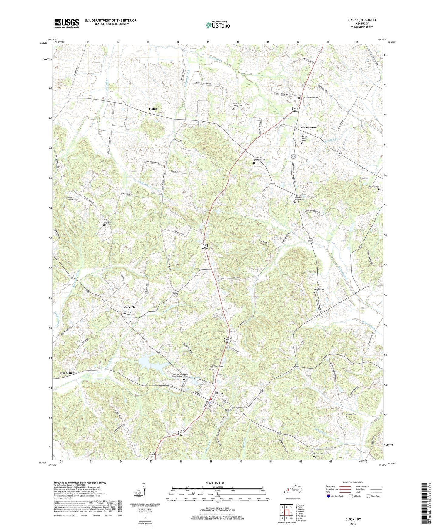
2022 topographic map quadrangle Dixon in the state of Kentucky. Scale: 1:24000. Based on the newly updated USGS 7.5' US Topo map series, this map is in the following counties: Webster, Union. The map contains contour data, water features, and other items you are used to seeing on USGS maps, but also has updated roads and other features. This is the next generation of topographic maps. Printed on high-quality waterproof paper with UV fade-resistant inks.
Quads adjacent to this one:
West: Bordley
Northwest: Waverly
North: Poole
Northeast: Robards
East: Sebree
Southeast: Slaughters
South: Nebo
Southwest: Providence
This map covers the same area as the classic USGS quad with code o37087e6.
Contains the following named places: Bad Stone Ditch, Camp Clark, Cavena Cemetery, Cavena Creek, City Lake, City of Dixon, Colman Ditch, Crews Cemetery, Dixon, Dixon Division, Dixon Fire Department, Dixon Lookout Tower, Dixon Post Office, Fairview Cemetery, Fairview Church, Jackson Cemetery, Jackson Ditch, Jonestand Ditch, Lakeview Missionary Baptist Church Cemetery, Little Zion, Little Zion Cemetery, McClendon - Chandler Cemetery, Oak Grove Cemetery, Parker Family Cemetery, Rock Stile Cemetery, Rock Stile Church, Sammons Cemetery, Shelton Cemetery, Stone Family Cemetery, Tapp and Snipes Cemetery, Tilden, Townsend Cemetery, Townsend Family Cemetery, Walker Lake, Wanamaker, Webster County, Webster County Coordinator 911, Webster County Emergency Medical Services, Webster County Sheriff's Office, Yates Cemetery, ZIP Code: 42409