MyTopo
Bordley Kentucky US Topo Map
Couldn't load pickup availability
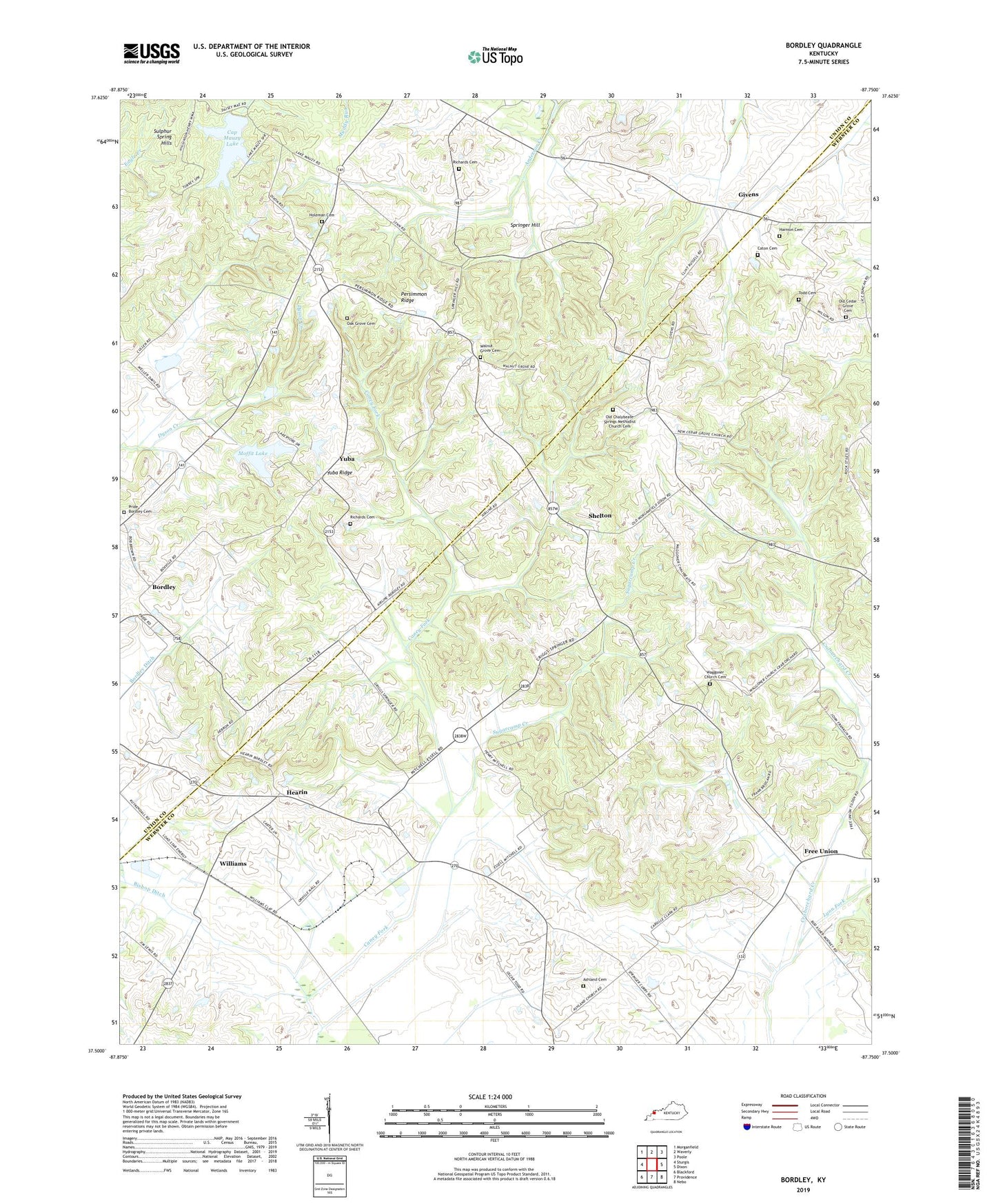
2022 topographic map quadrangle Bordley in the state of Kentucky. Scale: 1:24000. Based on the newly updated USGS 7.5' US Topo map series, this map is in the following counties: Webster, Union. The map contains contour data, water features, and other items you are used to seeing on USGS maps, but also has updated roads and other features. This is the next generation of topographic maps. Printed on high-quality waterproof paper with UV fade-resistant inks.
Quads adjacent to this one:
West: Sturgis
Northwest: Morganfield
North: Waverly
Northeast: Poole
East: Dixon
Southeast: Nebo
South: Providence
Southwest: Blackford
This map covers the same area as the classic USGS quad with code o37087e7.
Contains the following named places: Ashland Cemetery, Ashland Church, Bordley, Cap Mauzy Lake, Caton Cemetery, Cedar Grove Church, Free Union, Givens, Harmon Cemetery, Hearin, Holeman Cemetery, Lynn Fork, Moffit Lake, Nall Ditch, Oak Grove Cemetery, Old Cedar Grove Cemetery, Old Cedar Grove Church, Old Chalybeate Springs Methodist Church Cemetery, Persimmon Ridge, Pride - Bordley Cemetery, Richards Cemetery, Shelton, Springer Hill, Sugarcamp Creek, Todd Cemetery, Waggener Church, Waggoner Church Cemetery, Walnut Grove Cemetery, Walnut Grove Church, Williams, Yuba, Yuba Ridge