MyTopo
Sebree Kentucky US Topo Map
Couldn't load pickup availability
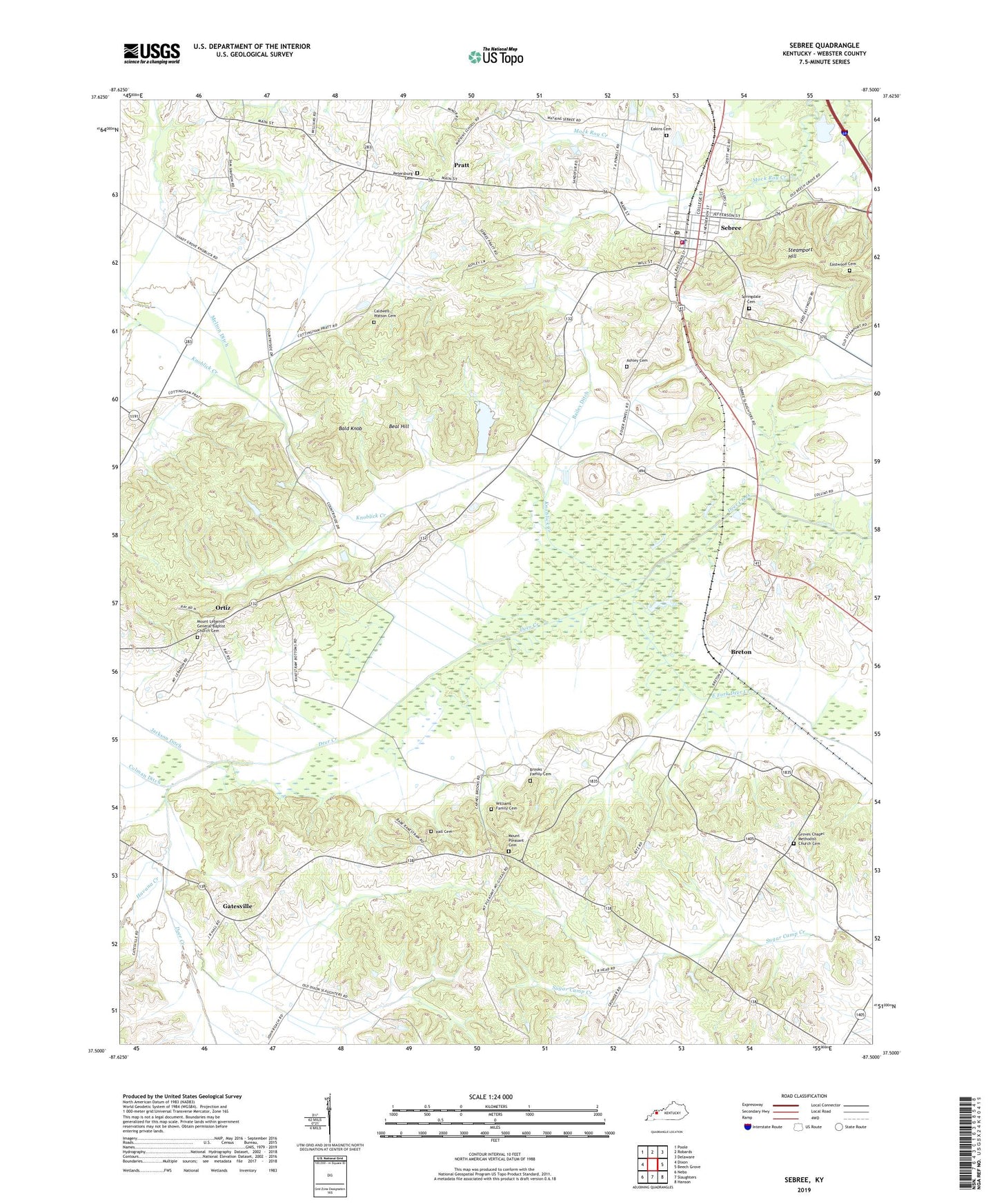
2022 topographic map quadrangle Sebree in the state of Kentucky. Scale: 1:24000. Based on the newly updated USGS 7.5' US Topo map series, this map is in the following counties: Webster. The map contains contour data, water features, and other items you are used to seeing on USGS maps, but also has updated roads and other features. This is the next generation of topographic maps. Printed on high-quality waterproof paper with UV fade-resistant inks.
Quads adjacent to this one:
West: Dixon
Northwest: Poole
North: Robards
Northeast: Delaware
East: Beech Grove
Southeast: Hanson
South: Slaughters
Southwest: Nebo
This map covers the same area as the classic USGS quad with code o37087e5.
Contains the following named places: Ashley Cemetery, Bailey Ditch, Bald Knob, Beal Hill, Breton, Brooks Family Cemetery, Caldwell - Watson Cemetery, City of Sebree, Eakins Cemetery, East Fork Deer Creek, Eastwood Cemetery, Gatesville, Groves Chapel, Groves Chapel Methodist Church Cemetery, Hall Cemetery, Havana Creek, Knoblick Creek, Melton Ditch, Mount Lebanon Church, Mount Lebanon General Baptist Church Cemetery, Mount Pleasant Cemetery, Mount Pleasant Church, Ortiz, Petersburg Cemetery, Petersburg Church, Pratt, Riley Family Home Historical Marker, Sebree, Sebree Division, Sebree Fire Department, Sebree Police Department, Sebree Post Office, Sebree Springs Park, Springdale Cemetery, Steamport Hill, Williams Family Cemetery, ZIP Code: 42455