MyTopo
Dot Kentucky US Topo Map
Couldn't load pickup availability
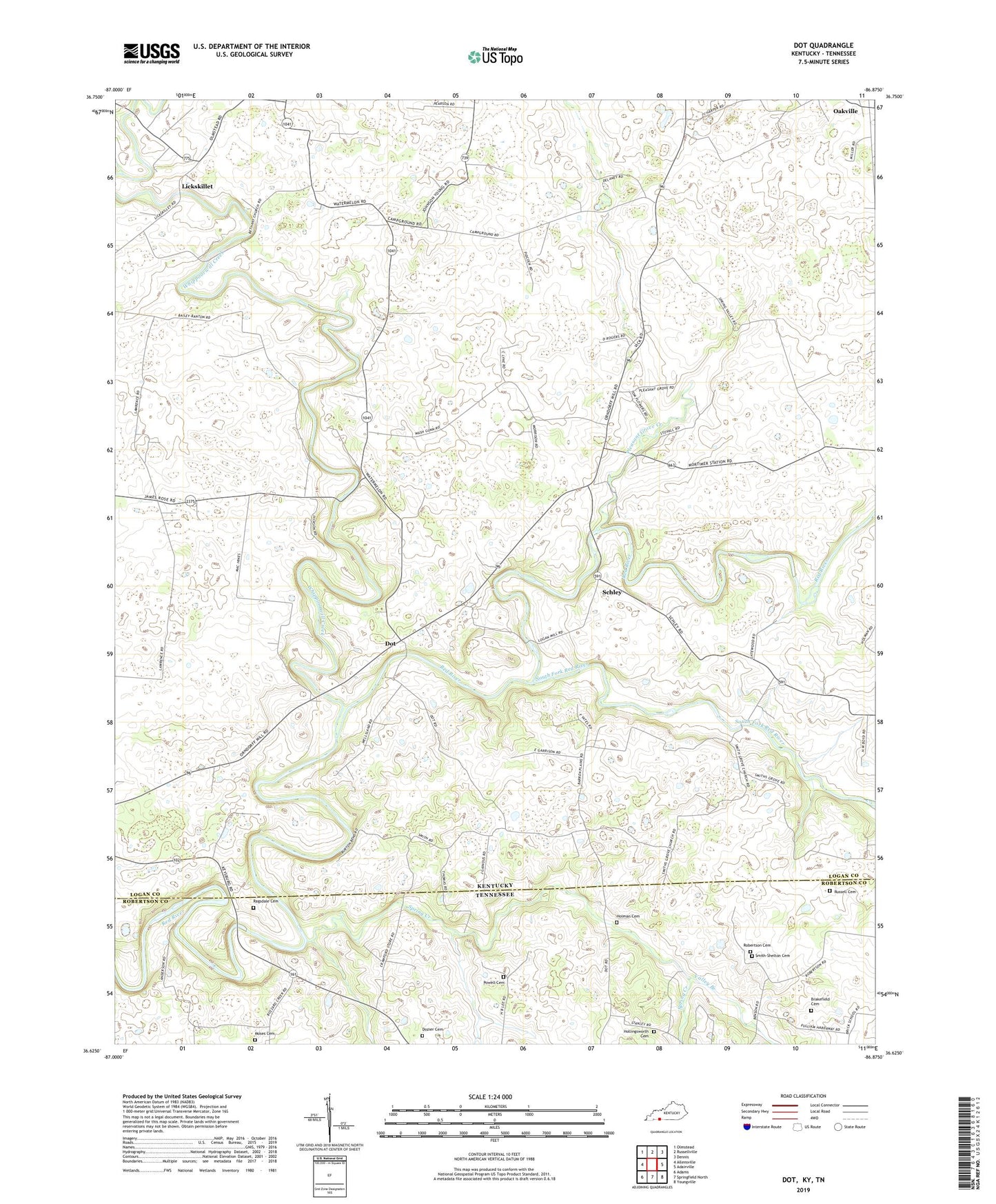
2022 topographic map quadrangle Dot in the states of Kentucky, Tennessee. Scale: 1:24000. Based on the newly updated USGS 7.5' US Topo map series, this map is in the following counties: Logan, Robertson. The map contains contour data, water features, and other items you are used to seeing on USGS maps, but also has updated roads and other features. This is the next generation of topographic maps. Printed on high-quality waterproof paper with UV fade-resistant inks.
Quads adjacent to this one:
West: Allensville
Northwest: Olmstead
North: Russellville
Northeast: Dennis
East: Adairville
Southeast: Youngville
South: Springfield North
Southwest: Adams
Contains the following named places: Adairville Division, Bethany Church, Brakefield Cemetery, Cedar Grove School, Center Point Church, Dot, Dozier Cemetery, Dripping Spring, Dripping Springs Church, Emmanuel Church, Hollingsworth Cemetery, Holman Cemetery, Lickskillet, Millertown Church, Moses Cemetery, Mount Lebanon Church, Oakland, Oakland Church, Oakville, Parson Campground, Pleasant Grove, Pleasant Grove Church, Pleasant Grove Creek, Powell Cemetery, Ragsdale Cemetery, Robertson Cemetery, Russell Cemetery, Salem Church, Schley, Smith Grove Church, Smithgrove, Smith-Shelton Cemetery, South Fork Red River, Spring Creek, Spring Valley Church, Valley Branch, Whippoorwill Creek