MyTopo
Olmstead Kentucky US Topo Map
Couldn't load pickup availability
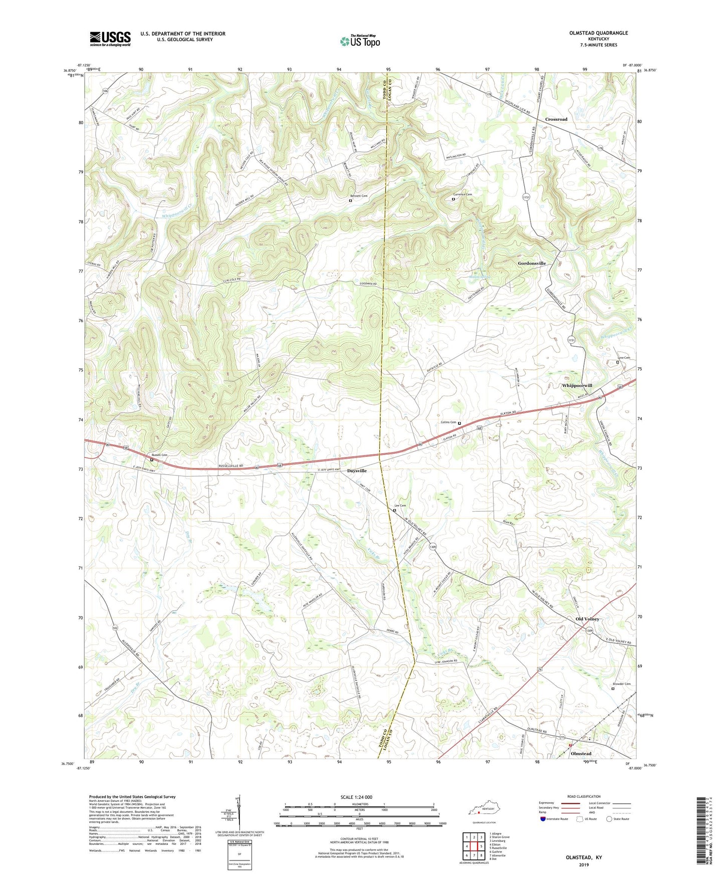
2022 topographic map quadrangle Olmstead in the state of Kentucky. Scale: 1:24000. Based on the newly updated USGS 7.5' US Topo map series, this map is in the following counties: Logan, Todd. The map contains contour data, water features, and other items you are used to seeing on USGS maps, but also has updated roads and other features. This is the next generation of topographic maps. Printed on high-quality waterproof paper with UV fade-resistant inks.
Quads adjacent to this one:
West: Elkton
Northwest: Allegre
North: Sharon Grove
Northeast: Lewisburg
East: Russellville
Southeast: Dot
South: Allensville
Southwest: Guthrie
This map covers the same area as the classic USGS quad with code o36087g1.
Contains the following named places: Bennett Cemetery, Browder Cemetery, Collins Cemetery, Crossroad, Cumberland Church, Currence Cemetery, Daysville, Garrett Branch, Gordonsville, Greenridge Church, Greenridge School, Johnson Chapel, Johnstown, Lee Cemetery, Lyne Cemetery, Mason Spring, Mount Gilead School, North Fork Whippoorwill Creek, Old Volney, Olmstead, Olmstead Fire Department, Pea Ridge, Pennick, Providence Methodist Church, Russell Cemetery, Union School, Whippoorwill