MyTopo
Russellville Kentucky US Topo Map
Couldn't load pickup availability
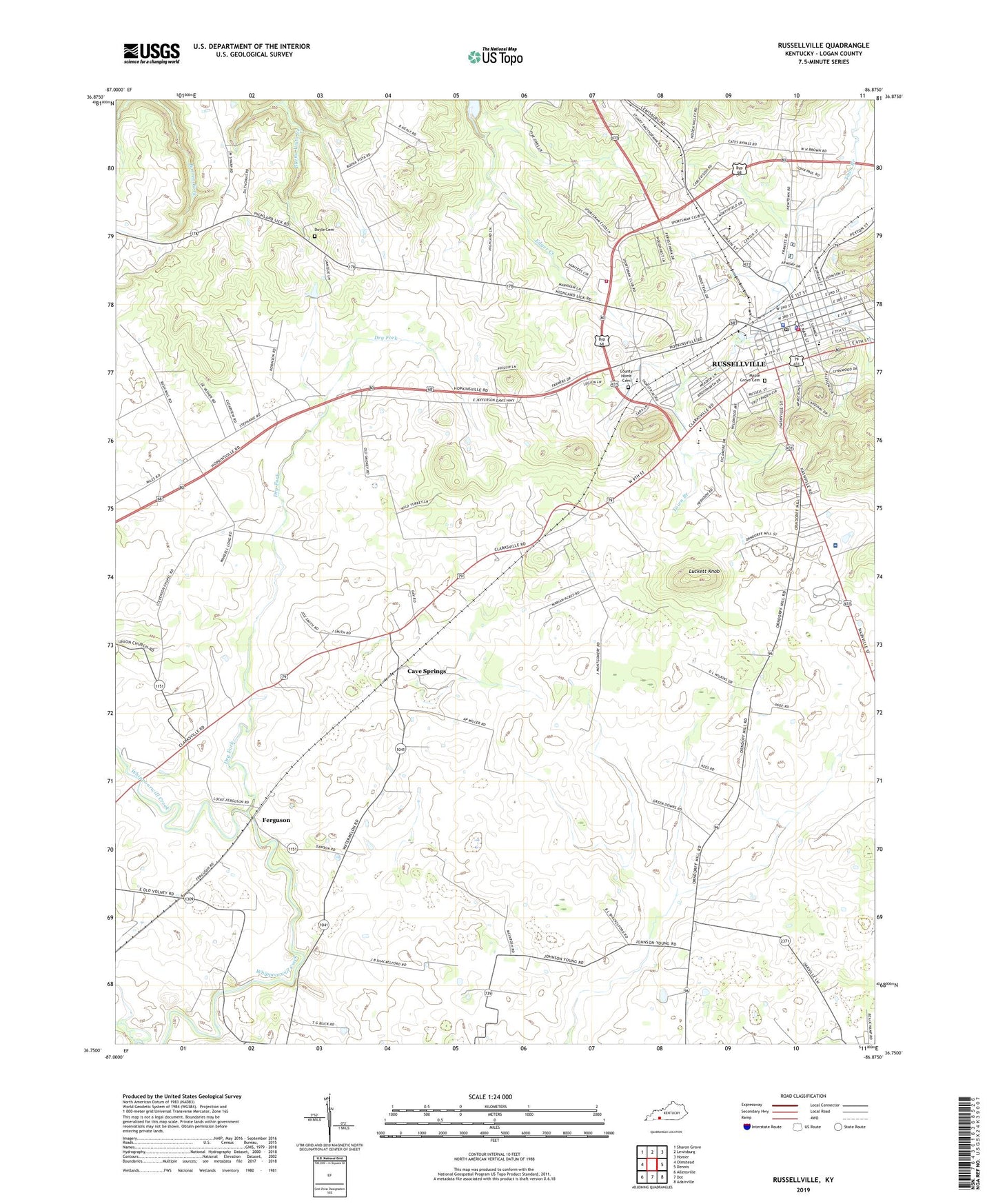
2022 topographic map quadrangle Russellville in the state of Kentucky. Scale: 1:24000. Based on the newly updated USGS 7.5' US Topo map series, this map is in the following counties: Logan. The map contains contour data, water features, and other items you are used to seeing on USGS maps, but also has updated roads and other features. This is the next generation of topographic maps. Printed on high-quality waterproof paper with UV fade-resistant inks.
Quads adjacent to this one:
West: Olmstead
Northwest: Sharon Grove
North: Lewisburg
Northeast: Homer
East: Dennis
Southeast: Adairville
South: Dot
Southwest: Allensville
This map covers the same area as the classic USGS quad with code o36086g8.
Contains the following named places: Cave Springs, City of Russellville, County Home Cemetery, Doyle Cemetery, Dry Fork, Ferguson, Lebanon Church, Logan County, Logan County Sheriff's Office, Logan Memorial Hospital, Luckett Knob, Maple Grove Cemetery, O'Roark Church, Post Oak, Post Oak Church, Red Oak Church, Rock Crusher Pond, Russellville, Russellville Division, Russellville Fire Department, Russellville Police Department, Russellville Post Office, Russellville Rural Fire Department, Stevenson Chapel, Vicks Branch, Walnut Grove, Walnut Grove Church, WBVR-FM (Russellville), Whitaker Grove Church, Williams Store, WRUS-AM (Russellville), ZIP Code: 42276